home
Pleshakov. Encyclopedia of travel. Countries world Book for students beginning. classes. A. Pleshakov s. A. Pleshakov encyclopedia of travel. book for primary school students"Encyclopedia of Travel". The book invites readers to different countries to tell and show how interesting and unique every corner of the Earth is! Travel, imaginary or real, is one of the most the best ways knowledge of the world. The book will help prepare for the trip, take readers to many wonderful places, and offer interesting tasks after the trip. "Encyclopedia of Travel" is addressed to younger schoolchildren. It is intended for use in lessons on the subject " The world" And
extracurricular activities
, for independent reading by a child at home and joint activities with adults.
Encyclopedia of travel. Countries of the world. Pleshakov A.A., Pleshakov S.A.
Description of the textbook
Good luck!
There are more than 200 countries in the world. Where should I go? We have chosen five countries and will make five trips. Only five. But they say that in one trip, even if it lasts only a week, you can gain more knowledge and impressions than in several months of ordinary life. Well, let's check it out!
Of the countries we have chosen, Hungary is the closest. By plane from Moscow to Budapest, the capital of Hungary, you can fly in 2 hours 45 minutes. That's where we'll go first. Then we will visit Austria. The flight from Moscow to Vienna, the capital of this country, will take 3 hours.
Our next trip is to Greece. You can fly to Athens, the capital of Greece, from Moscow in 4 hours 20 minutes. And then we will go to the United Arab Emirates. The flight there from Moscow takes about 5 hours. And finally, we will visit Argentina. Getting from Moscow to the capital of Argentina, Buenos Aires, takes at least 20 hours!.
It's better to travel with those you love. A very friendly family will visit all countries with us: | Seryozha, his sister Nadya, their father and mother. Seryozha and Nadya’s dad is an artist, and their mom works in
botanical garden
Once upon a time, schoolchildren wrote in their notebooks with a fountain pen, and the ink was stored in a bottle. What a hassle it was! with this ink! Blots were often left in notebooks, and sometimes ink was spilled due to carelessness. And then a pen appeared with which you could write for a long, long time and without
all sorts of
ink! It was a ballpoint pen. A rod was inserted into it with a special paste and a ball at the end. This pen was invented by the Hungarian inventor Laszlo Biro. Therefore, Hungary can be considered the birthplace of the ballpoint pen. What else is remarkable about Hungary? To find out, let's go on our first trip!
We are considering business card Hungary
Studying the “personal data” of Hungary
Full name: Republic of Hungary. Capital: Budapest. Head of state: president. Official language: Hungarian. Currency: forint.
Learn polite words used by Hungarians
(Let's get acquainted with the safety rules
Traveling around Hungary is not fraught with any particular dangers. However, you need to remember that even in a safe country you need to carefully monitor the safety of your wallet and documents. You should not leave things unattended, especially cameras, video cameras and mobile phones. On the streets and roads you must comply normal rules security. When visiting the famous Hungarian baths, remember that the water in some pools is quite hot, so caution is a good idea. Of course, when swimming you need to follow the generally accepted rules of behavior on the water.
Hungary is a small country located in Central Europe. Hungary's neighbors are 7 countries: Slovakia in the north, Ukraine in the northeast, Romania in the east, Croatia and Serbia in the south, Austria and Slovenia in the west. Hungary has no access to the sea.
The capital of Hungary is very beautiful city Budapest, located on the Danube River. This is the most Big City countries. The five largest Hungarian cities also include Döbrecen, Miskolc, Szeged and Pécs. In Hungarian, the name of the country sounds like “Magyarorsag”, which means “country of the Magyars”. The Magyars (as the Hungarians call themselves) settled in what is now Hungary in the 9th century. The Magyars were not the first inhabitants of these lands; Celtic tribes lived here long before them, and then the Romans.
Kings ruled Hungary for many centuries. The Hungarians especially reverence King Matthias, who lived in the 15th century. He was a wise ruler, a talented commander, and a patron of scientists and artists. During his reign, Hungary became a powerful kingdom where science and art flourished. The first printed book in Hungary was published, which was called “Chronicle of the Hungarians”.
From 1867 to 1918, Hungary was part of the Austro-Hungarian Empire. In the 20th century, the country experienced many events, both difficult, tragic, and joyful. A huge role in the history of Hungary was played by its liberation from the Nazis. Soviet troops in 1945. Modern? The Hungarian Republic was proclaimed in 1989.
Now let's take a look at the history of the Hungarian capital - Budapest.
Two thousand years ago, in its place was the ancient Roman city of Aquinc (Aquincum). Its ruins were discovered during excavations by archaeologists. Now you can walk the streets ancient city and see the ruins of many buildings: residential buildings, temples, shops, baths.
Ruins of Aquincus
Later the cities of Buda and Pest arose. They were located on opposite banks of the Danube: Buda - on the right, mountainous bank, Pest - on the left, flat bank. In 1873, these independent cities were united. The cities were united, and their names were united. So Buda and Pest became Budapest.
The flag of Hungary consists of three horizontal stripes: red, white and green. The meaning of the colors of the Hungarian flag is explained as follows. The red color symbolizes the struggle for freedom and independence of the country. White color - the purity and nobility of the thoughts of the people, their loyalty to their homeland. Green color means hope for a better future for Hungary.
The coat of arms of Hungary is a shield topped with a royal crown. The crown recalls the past of the country, which, as we already know, was a kingdom for many centuries. The cross on the shield speaks of the Christian faith of the people. The green hills at the bottom of the coat of arms symbolize the country's mountains, and the silver stripes on the left represent the rivers.
Encyclopedia of travel. Countries of the world.
© Boris Yasny, 2018
ISBN 978-5-4493-1782-7
Created in the intellectual publishing system Ridero
OUR ASTRONOMICAL ADDRESS
Each of us knows our address. House, street, city, country, finally, planet Earth. Our planet orbits at a distance of one astronomical unit, equal to 149,597,870 km. around the star Sun in the Solar System.
Light travels this distance in 8 minutes and 20 seconds. In a year, light travels 63,241.126 astronomical units or ≈ 9,460,528,447,488 km. In the vast Universe solar system is located in the Milky Way galaxy in the Orion Arm at a huge distance of 26 thousand light years from the center. And together with another 200 billion stars, it revolves around the center of the galaxy.
Our neighbors - the Andromeda galaxy, the Large and Small Magellanic clouds, together with our galaxy are part of the Virgo supercluster of galaxies, covering space for about 200 million light years, and numbering about thirty thousand galaxies.
Planet Earth - the third planet from the Sun has 6 continents: Eurasia, Africa, Australia, Antarctica, Northern and South America 5 of them (except Antarctica) are home to 251 countries and a population of more than 7.55 billion people.
World map
EUROPE
GREAT BRITAIN
Territory (78 in the world) – 243809 km2. Population (22 in the world) – 63,395,000 people. The official language is English.
The United Kingdom of Great Britain and Northern Ireland is located on the islands of the British archipelago in northern Europe. And also: in the north-eastern part of the island of Ireland, on the Hebrides, Shetland, Orkney Islands and Anglesey, Arran, White in the Atlantic Ocean.
The United Kingdom is washed by the North, Irish, Celtic and Hebridean seas. In the southeast, the English Channel (35 km) separates it from France. We often call Great Britain England, but England is only part of the United Kingdom. It also includes Scotland in the north, Wales in the west of the British archipelago and Northern Ireland.
The form of government is a parliamentary monarchy. The Queen hosts parades, organizes balls, and is a symbol of the state. The country is governed by a prime minister and parliament. Great Britain big country. There are high mountains here (Ben Nevis 1344m), Ben – Makdi (1309m), and large rivers: the Severn, Thames, Trent, and large lakes: Doch Neagh, Loch Ness (which is said to be inhabited by the dinosaur Nessie). There are Royal Forests with huge old oak, birch and other deciduous trees. There are pine groves and plantings, grassy pastures and heather-covered hills. Roe deer and deer, raccoons and foxes, otters, stoats and weasels, and many birds and fish in coastal waters live here. But most of all in the Kingdom of rabbits and gray hares. The weather in Great Britain is foggy and rainy, but warm thanks to the Gulf Stream.
Since ancient times, people have settled on this land and built cities. But the legions of the Roman Empire came and captured Britain, making it their province. Rome ruled it for 400 long years, but fell after the invasion of Germanic and Anglo-Saxon tribes. The British lands then united to form the Kingdom of England. The British built a mighty fleet and set off across all seas and oceans to settle new lands and conquer colonies. They began to rule India and Australia, America and South Africa. This is how the British Empire came into being. Then England and Scotland united and called themselves Great Britain. Ireland joined them. The United Kingdom of Great Britain and Ireland was formed. The British Empire owned many overseas colonies and was at war with many countries. By now, many colonies have become independent states, but Great Britain is still one of the most powerful countries in the world.
Its capital is London
London has stood on the River Thames for many centuries. Neither fires nor plague epidemics could destroy it. Never once was he captured by enemies. London has many ancient castles, palaces and cathedrals. Among them: the Palace of Westminster - has been the home of the British government for over 900 years, Buckingham Palace - the residence of monarchs, Westminster Abbey - a Gothic church, built intermittently for about 500 years since 1245, St. Paul's Cathedral - a cathedral, the residence of a bishop, Tower Bridge - a drawbridge the bridge is a symbol of London, Trafalgar Square was built in honor of the victory over France in 1805, Piccadilly Circus is the center of London. There are a lot of museums, beautiful modern buildings, parks and squares.
Great Britain is the birthplace of great scientists: Newton, Darwin, Faraday. Writers: Swift (author of stories about Gulliver), Defoe (who wrote a book about Robinson Crusoe), Shakespeare (Hamlet). Composers: Byrd, Purcell, Sullivan. Artists: Constable, Blake, Palmer.
Did you know that Great Britain has had the most queens to rule a country? That "Big Ben" is not the name of a tall clock tower, but the name of a huge bell inside it. That it rarely snows in London in winter? This is a whole event. Residents drop everything and run outside to build snowmen and ride down slides on inflatable mattresses. That all swans on the River Thames are legally the property of the Queen?
G E R M A N I
Territory (62 in the world) – 357,021 km2. Population (16 in the world) – 80,523,000 people. The official language is German.
The Federal Republic of Germany is located in the center of Europe. This is a big country. It is governed by parliament and the chancellor. In the north of Germany there is a plain, and in the south there are the Alps. The highest mountain is called Zugspitze. Its height is 2962 meters. Many rivers flow through Germany. The largest of them are the Rhine, Danube, Elbe and Oder. There are lakes. The largest is Bodenskoye. The weather changes frequently. A sunny day can suddenly turn cold. In the north of the country the climate is maritime, in the south it is temperate continental. But there are no severe frosts and heat. Forests are found only on mountain slopes. Spruce, pine, and beech trees grow in the forests. There are a lot of flowers and cultivated plants on the plains.
Animals of Germany are wild boars, foxes, red deer, roe deer, fallow deer, squirrels and hares, marmots and otters. There are many ducks, geese, wading and small birds near the water, and there are storks. About 70 species of fish are found in German water bodies. These are mainly carp, as well as eel, salmon and herring.
Even in ancient times, warlike tribes lived in Germany. The Romans called them barbarians. In 476, the barbarians conquered the Roman Empire and created the Frankish Empire led by Charlemagne. Germany and Italy became part of it. In 962, the Holy Roman Empire was founded by King Otto I the Great. It was to become the successor to the Ancient Roman Empire and the Frankish Empire of Charlemagne. For many centuries the Holy Roman Empire was the center of Western Christendom. Since 1512, it began to be called the Holy Roman Empire of the German Nation.
Germany has come a long way from medieval fragmentation and peasant wars, through the Renaissance until the rise of the Kingdom of Prussia. As a result of the wars with the French Emperor Napoleon in 1806, the Holy Roman Empire fell. In its place, the Confederation of the Rhine was formed. Germany became Napoleon's ally. After the defeat of Napoleon, the Confederation of the Rhine ceased to exist. In the 19th century, the German lands united into the German Empire.
The German Empire began to seize colonies. By the outbreak of the First World War in 1914, Germany had the most powerful army in the world. But in 1918 it was defeated by Russia, England, France and America. Kaiser Wilhelm II abdicated the throne, after which the Weimar Republic was proclaimed. After revolutionary uprisings and a change of governments in 1933, Adolf Hitler and the National Socialist Fascist Party came to power.
The Nazi regime was called the Third Reich. Year after year, Hitler intensified his terror and dictatorship. Physically destroyed all his opponents. In 1939, Germany started World War II. Second World War is a grandiose tragedy for all humanity. 61 states took part in it. Thousands of cities and villages were destroyed. 54 million people died. 90 million were maimed. At the cost of enormous efforts and sacrifices, the alliance of Russia, England and the USA managed to defeat fascism. On May 9, 1945, Germany surrendered. On May 23, 1945, the German Empire ceased to exist. The history of the formation and unification of post-war Germany is a history of democratic transformations and an amazing economic recovery. Germany has again taken a leading place among the countries of the world. All cities in Germany are stunningly beautiful, but the official capital is Berlin.
Berlin is the second largest city in Europe after London. Berlin is a very green city. It contains a huge number of parks, squares, groves, rivers and canals. Tiergarten Park and the Botanical Garden are favorite recreational spots for Berliners. Magnificent buildings adorn Berlin. This is the Reichstag on Republic Square, the German State Opera, the Humboldt University, the Museum German History, Bebelplatz and St. Hedwig's Cathedral. Many theaters and art galleries. Interesting fact. There are more than a hundred in the world settlements with the name Berlin!
Germany is the country that gave the world great thinkers: Kant, Hegel, Schopenhauer. Brilliant writers: Sebastian Brant, Bertolt Brecht, Goethe, Schiller, Feuchtwanger. Composers: Bach, Wagner, Abel, Beethoven, Brahms, Handel. Scientists and inventors: Gaus, Geiger, Heisenberg, Kepler, Leibniz, Ohm, Plnck, Roentgen, Schliemann, Einstein. Artists: Altdorfer Albrecht, Grunewald Matthias, Durer, Rubens.
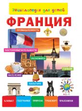
FRANCE
Territory (48th in the world) – 674,685 km2. Population (21 in the world) – 65,951,000 people. The official language is French.
The head of the French Republic is the President. The head of government is the prime minister. Laws are approved by Parliament. Most of France is located in Western Europe. The state also includes the island of Corsica in the Mediterranean Sea and more than 20 dependent territories.
France is washed by the English Channel, the North Sea, Atlantic Ocean and the Mediterranean Sea. In the north and west of the country there are plains and lowlands. Plains occupy 2/3 of the country's territory. The rest is mountain ranges: the Alps, Pyrenees, Jura, Ardennes, Massif Central and Vosges. The highest mountain is Mont Blanc (4807m).
The largest rivers of the country: the Seine and its tributaries, Garonne, Rhone, Loire. There are not many lakes. The largest are Bourget, Annecy and Lake Geneva. Climate on European territory France is temperately maritime, turning into temperate continental in the east, and subtropical on the southern coast. Summer is hot and dry +25 degrees C, in winter it rains +7 -8 degrees C.
Forests occupy a third of the country's territory. Hazel, birch, and oak grow in the north. spruce and cork. On the Mediterranean coast there are palm trees and citrus fruits. There are many vineyards in France. Among the fauna, deer, fox, roe deer, and wild boar stand out. There are a lot of birds, including migratory ones. Reptiles are rare; among snakes there is one poisonous viper. Many types of fish in the waters of seas and rivers. Mackerel, hake, flounder, herring, tuna, cod, sardine.
In ancient times, Celtic Gaul tribes lived in France. As a result Gallic War Julius Caesar, in the 1st century BC, France became part of the Roman Empire as the province of Gaul. In 486, Gaul was conquered by the Germanic Frankish tribes. The Frankish state was formed. In the 10th century, the country began to be called France.
The following times are remarkable Crusades, religious wars and Hundred Years' War with England. It began in 1337 and ended, with the participation of Joan of Arc, with the surrender of the British. By the reign of Louis XI in 1461-1483, France turned into absolute monarchy. France subsequently fought with Spain for control of Italy. 1572 religious wars between Catholics and Protestants resulted in the massacre of Protestants in Paris on St. Bartholomew's Night. Then Protestants were given equal rights. Thirty Years' War with the Swedes. When the country was ruled by the minister of King Louis XIII, Cardinal Richelieu (familiar to us from the book “The Three Musketeers”). Then the reign of the king is the sun Louis XIV, the uprising of the urban lower classes - the Fronde, against Mazarin and Queen Mother Anne of Austria. War with Spain, Dutch War, Persecution of Protestants again. Reign of Louis XV from 1715 to 1774. In 1789 – Great French revolution. Overthrow of the monarchy. First Republic. Jacobin terror. Capture of the Netherlands, Venice and the march on Egypt. In 1799 Napoleon becomes emperor. Conquers Europe by military means. March on Russia. Defeat and flight of Napoleon to France. 1815 -Battle of Waterloo, defeat of Napoleon and his capture on the island of St. Helena. Then restoration royalty. Second Republic. Second Empire - Napoleon III. Third Republic. 1870 - 1871 war with Prussia. Parisian commune. 1914 – First World War. 1939-1945-World War II. France fought against Germany in both wars. Fourth Republic. And in 1958 the Fifth Republic. Charles de Gaulle was elected president. The French colonies declared independence. And finally, joining the European Union. The capital of France is Paris.
Paris was founded in the 3rd century BC by the Celtic tribe of the Parisians. From III – IV centuries. known as the Gallo-Roman city of Parisia. Since the end of the 10th century, with interruptions, it has been the capital of France. Paris has a huge number of attractions. These include not only architectural buildings, but squares, streets, bridges and parks. In Paris 1800 historical places and 130 museums. The symbol of Paris is the Eiffel Tower. Also the Tour Montparnasse Tower, the Sacré-Coeur Basilica, the Louvre Museum, the Tuileries Garden, Champs Elysees Avenue, Triumphal Arch, Area of the star. Great Arch of Defense, military museum - Invalides, Pantheon. The historical center is the Ile de la Cité, Notre Dame Cathedral and Sainte-Chapelle. In the suburbs is the royal palace of Versailles. And many modern buildings, sports and scientific centers.
Did you know that Europe's only Disneyland is located in Paris? And that the magnificent sculpture of the Statue of Liberty was given to the Americans by France? The whole world knows the names of the great French writers and poets: Balzac, Dumas, Hugo, Moliere, La Fontaine. Scientists and inventors: Eiffel, Louis Pasteur, Blaise Pascal, Montgolfier Brothers, Ampère, Laplace, Lagrange. Artists: Gauguin, Degas, Monet, Renoir, Rodin. Musicians and composers: Bizet, Gounod, Debussy, Ravel. Singers and performers: Joe Dassin, Charles Aznavour, Edith Piaf, Patricia Kaas. Film actors: Jean Marais, Jean Reno, Michel Mercier, Mylene de Mongeau, Louis De Funes, Depardieu, Gabin, Bourville. Athletes: figure skaters Nathalie Néchalet and Fabien Bourzat, bioathlete Simon Fourcade, speed skater Alexis Conten, football players Zinedine Zidane, Raymond Domenech, Lilian Thuram. It is simply impossible to list all the names. It is impossible to exaggerate the contribution of France to world culture, science and industrial production perfumery, wines, mechanical engineering.
Size: px
Start showing from the page:
Transcript
1 A. A. Pleshakov S. A. Pleshakov ENCYCLOPEDIA OF TRAVEL Countries of the world Book for students primary classes Moscow "Enlightenment" 2015
2 UDC:502 BBK 2я6я72 P38 Contents Good journey! 4 M. A. Pleshakova took part in writing the chapter “The Third Journey: Greece”. The book uses photographs of the authors. First trip: Hungary Second trip: Austria 5 33 Third trip: Greece 61 P38 Pleshakov A. A. Encyclopedia of travel. Countries of the world: book. for beginning students class / A. A. Pleshakov, S. A. Pleshakov. M.: Enlightenment, p. : ill. ISBN Which country can be considered the birthplace of the ballpoint pen? Where is the tallest building in the world? Who invented the famous Sirtaki dance? The Encyclopedia of Travel will answer these and many other questions. The book invites readers to different countries to tell and show how interesting and unique every corner of the Earth is! Travel, imaginary or real, is one of the best ways to understand the world. The book will help prepare for the trip, take readers to many wonderful places, and offer interesting tasks after the trip. “Encyclopedia of Travel” is addressed to primary schoolchildren. It is intended for use in lessons and extracurricular activities on the subject “The World Around Us”, for independent reading at home and joint activities between a child and an adult in the family. UDC:502 BBK 2я6я72 ISBN Prosveshchenie Publishing House, 2015 Artistic design. Prosveshcheniye Publishing House, 2015 All rights reserved Fourth Journey: United Arab Emirates Fifth Journey: Argentina Index Dictionary

3 Good luck! There are more than 200 countries in the world. Where should I go? We have chosen five countries and will make five trips. Only five. But they say that in one trip, even if it lasts only a week, you can gain more knowledge and impressions than in several months of ordinary life. Well, let's check it out! Of the countries we have chosen, Hungary is the closest. By plane from Moscow to Budapest, the capital of Hungary, you can fly in 2 hours 45 minutes. That's where we'll go first. Then we will visit Austria. The flight from Moscow to Vienna, the capital of this country, will take 3 hours. Our next trip is to Greece. You can fly to Athens, the capital of Greece, from Moscow in 4 hours 20 minutes. And then we will go to the United Arab Emirates. The flight there from Moscow takes about 5 hours. And finally, we will visit Argentina. Getting from Moscow to the capital of Argentina, Buenos Aires, takes at least 20 hours! It's better to travel with those you love. A very friendly family will visit all countries with us: Seryozha, his sister Nadya, their father and mother. Seryozha and Nadya’s father is an artist, and their mother works in a botanical garden. So, the travel plan has been drawn up. Curious team assembled. Good luck! First trip: Hungary Picture: Family (father, mother, Seryozha and Nadya) greets readers. Dad has a camera, mom has a small guide book. The size of the picture is 157 x 104 mm (bleed). 4
4 The boy looks at the photograph. Once upon a time, schoolchildren wrote in their notebooks with a fountain pen and carried the ink in a bottle. What a hassle it was with this ink! Blots were often left in notebooks, and sometimes ink was completely spilled by carelessly pushing the bottle. And then a pen appeared with which you could write for a long, long time and without any ink! It was a ballpoint pen. A rod with a special paste and a ball at the end was inserted into it. The ballpoint pen was invented by the Hungarian inventor Laszlo Biro. Therefore, Hungary can be considered the “homeland” of the ballpoint pen. What else is remarkable about Hungary? To find out, let's go on our first trip! Getting ready for a trip Considering the business card of Hungary The Parliament Building in Budapest In Russian Hello, good afternoon! Learn polite words used by Hungarians In Hungarian Jo2napot! Approximate pronunciation Yoono2pot! Goodbye Viszontla2ta2sra Vi2sontlatashro Please (request) We are studying the “personal data” of Hungary Full name: Republic of Hungary. Capital: Budapest. Head of state: president. Official language: Hungarian. Currency: forint. Ke2rem Ke2yrem Thank you Köszönöm Kösönöm Sorry Bocsa2natot Bo2chanotot! Let's get acquainted with the safety rules Traveling around Hungary is not fraught with any particular dangers. However, you need to remember that even in a safe country you need to carefully monitor the safety of your wallet and documents. You should not leave things unattended, especially cameras, video cameras and mobile phones. Normal safety precautions must be observed on streets and roads. When visiting the famous Hungarian baths, remember that the water in some pools is quite hot, so caution is a good idea. Of course, when swimming you need to follow the generally accepted rules of behavior on the water. A girl writes something in a notebook. 6 7
5 Country on the map Hungary is a small state located in Central Europe. Hungary's neighbors are 7 countries: Slovakia in the north, Ukraine in the northeast, Romania in the east, Croatia and Serbia in the south, Austria and Slovenia in the west. Hungary has no access to the sea. Miskolc Szeged Pecs Budapest Debrecen The capital of Hungary is the very beautiful city of Budapest, located on the Danube River. This is the largest city in the country. The top five largest Hungarian cities also include De2brecen, Mi2skolc, Se2ged and Pecs. From the history of the country In Hungarian, the name of the country sounds like “Magyarorsag”, which means “country of the Magyars”. The Magyars (as the Hungarians call themselves) settled in what is now Hungary in the 9th century. The Magyars were not the first inhabitants of these lands; Celtic tribes lived here long before them, and then the Romans. Kings ruled Hungary for many centuries. The Hungarians especially reverence King Matyas, who lived in the 15th century. He was a wise ruler, a talented commander, and a patron of scientists and artists. During the years of his power, Hungary became a powerful kingdom where science and art flourished. The first printed book in Hungary, called “Chronicle of the Hungarians,” was also published. Sculpture of King Matthias 8 9
6 From 1867 to 1918, Hungary was part of the Austro-Hungarian Empire. In the twentieth century, the country experienced many events, both difficult, tragic, and joyful. A huge role in the history of Hungary was played by its liberation from the Nazis by Soviet troops in 1945. The modern Hungarian Republic was proclaimed in 1989. Now let's take a look at the history of the Hungarian capital Budapest. Two thousand years ago, in its place was the ancient Roman city of Aquincum. Its ruins were discovered during excavations by archaeologists. Now you can walk along the streets of the ancient city and see the ruins of many buildings: residential buildings, temples, shops, baths. Flag and coat of arms The flag of Hungary consists of three horizontal stripes: red, white and green. The meaning of the colors of the Hungarian flag is explained as follows. The red color symbolizes the struggle for freedom and independence of the country. White color symbolizes the purity and nobility of the thoughts of the people, their loyalty to the homeland. Green color means hope for a better future for Hungary. The coat of arms of Hungary is a shield topped with a royal crown. The crown recalls the past of the country, which, as we already know, was a kingdom for many centuries. The cross on the shield speaks of the Christian faith of the people. The green hills at the bottom of the coat of arms symbolize the country's mountains, and the silver stripes to the left of the river. Ruins of Aquincum Later, the cities of Buda and Pest arose. They were located on opposite banks of the Danube: Buda on the right, mountainous bank, Pest on the left, flat one. In 1873, these independent cities were united. The cities were united, and their names were united. So Buda and Pest became Budapest. Nature and its protection The main river of Hungary, the Danube, flows from north to south, dividing the country into two almost equal parts. East of the Danube to the border with Romania lies the vast Alföld Plain, which means “lowland” in Russian. It flows large rivers: Ti2sa and its tributary Körös. There are agricultural lands here. To the west of the Danube, a plain covered with hills stretches to the borders with Austria and Croatia. Here and there there are also low mountains. In this part of the country there is largest lake Hungary Balato2n. The Ma2tra mountain range is located in northern Hungary. Here is the highest point of the country, “the top of Hungary,” as they say here. This is Mount Ke2kesh with a height of 1014 m
7 Hungary is very rich in thermal springs (from the Greek word "therme" heat, heat). These are sources with warm and hot water. The water in them has beneficial properties and has been used since ancient times to improve the health of the body and treat many diseases. Hungarian summers are dry and hot, especially in the eastern part of the country. The thermometer often shows Winter in Hungary is quite mild, there are almost no severe frosts. Average temperature in winter 1. More than half of Hungary's territory is now occupied by agricultural land: arable land and pastures, orchards and vineyards. And once upon a time, most of the country was covered with forest. Today, forests consisting of oak, beech, ash and coniferous trees occupy less than 1/5 of Hungary's territory and are located mainly on mountain slopes. The forests are inhabited by brown bears, wild boars, deer, and lynxes. Beavers live along the banks of rivers. Drawings: bustard, beaver, trout. In a natural environment! The size of the picture is 157 x 117 mm. In the vastness of the Alföld, the bustard is a very large steppe bird, listed in the International Red Book. The rivers and lakes are home to trout, pike perch, pike and other fish. To protect and preserve nature, 10 national parks have been created in Hungary. They protect a variety of plant and animal species, including rare ones, as well as unique natural objects. For example, caves. Thus, in the north of Hungary, on the border with Slovakia, the Aggtelek National Park is located. There are several hundred caves in this mountainous region! The length of the largest of them is 26 km. This is one of the largest caves in Europe. It is richly decorated with stalactites and stalagmites. Aggtelek Caves are a World Natural Heritage Site. The largest national park in Hungary is Hortobágy. It is located in the eastern, flat part of the country. The Hungarians call these places “Pusta”, that is, wasteland. Here, in the vast expanses of the steppe, cows, sheep, and goats graze. But these are no ordinary pets. They belong to ancient rare breeds, almost extinct by the middle of the twentieth century. Thanks to the creation national park managed to preserve these breeds. National Park Hortobágy is included in the World Cultural Heritage List. In the Aggtelek cave Hungarian gray cows 12 13
A. A. Pleshakov S. A. Pleshakov ENCYCLOPEDIA OF TRAVEL Countries of the world Book for primary school students Moscow “Enlightenment” 2015 UDC 373.167.1:502 BBK 2я6я72 P38 In writing the chapter “The Third Journey:
Encyclopedia of travel countries of the world pleshakov free download >>>
Encyclopedia of travel countries of the world of pleshakov free download >>> Encyclopedia of travel countries of the world of pleshakov free download Encyclopedia of travel countries of the world pleshakov free download He was
MIŠKOLZ HUNGARY THE CITY OF MIŠKOLZ A city in the north-east of Hungary is located at the foot of the Bükk mountain range in the valley of the Sinva River, which gives a special flavor to the squares and terraces of the city. Thanks to the advantageous
Topic: “Traveling around home country" 2nd grade Purpose of the lesson: Personal development in the process of training and education. Objectives: 1) Contribute to: - the development of children’s spatial understanding; - education of love
Municipal state preschool educational institution of Novosibirsk kindergarten 443 combined type abstract of open GCD for patriotic education in preparatory group 4 teacher
Bulgaria Purpose: To get acquainted with the history of the Republic of Bulgaria. Objectives: Explore its surroundings. Explore the sights. Acquainted with natural resources. Economy-geographical
Makukhina Larisa Alekseevna teacher, Honorary worker general education RF MBOU "Secondary School 2 MO "Akhtubinsky District" Akhtubinsk, Astrakhan Region STUDYING LOCAL HISTORY IN PRIMARY SCHOOL Abstract: in this
State budgetary preschool educational institution kindergarten 52 of the Frunzensky district of St. Petersburg. Summary of a lesson on speech development Topic: “Nature of Russia” for senior preschool children
Municipal budgetary preschool educational institution "Kindergarten 56 "Hummingbird" (MBDOU "Kindergarten 56 "Hummingbird") Summary of the lesson - games on patriotic education on the topic: "Russia is my Motherland"
Municipal educational institution "Secondary school 3 named after. S.V. Isheev" Yasnogorsk, Tula region" Summary of a lesson on the surrounding world in grade 2B on the topic "Countries of Europe. A cloud's journey through Europe." Teacher Shirokova E.G. Lesson objective: study
I International Marathon “Wonderful Planet. Secrets of lakes, seas and oceans" (for 2nd grade students) Answers The answer must be presented strictly in the form of ONE WORD, LETTERS or NUMBERS (according to the condition
Municipal budgetary preschool educational institution kindergarten "Rodnichok" s. Bykov GCD by cognitive development Topic: Completed by: Educator Lushchenko M.S. First qualification category
Municipal preschool educational institution Kindergarten 28 “Snegirok” of general developmental type Istrinsky municipal district Lesson summary for the middle group on moral and patriotic
Municipal stage All-Russian Olympiad for schoolchildren in geography Khanty-Mansiysk autonomous region Yugra 2015-2016 academic year 8 CLASS Code Students work without maps, without geographical atlases, without
I International Marathon “Wonderful Planet. Secrets of lakes, seas and oceans" (for students in grades 3-4) Answers The answer must be presented strictly in the form of ONE WORD, LETTER or NUMBER (according to the condition
CALENDAR-THEMIC PLANNING ON THE WORLD AROUND Grade 2 Where we live (2 hours) p/p U r Lesson topic 1 1 Where we live. Our “address” in the world: planet Earth, country Russia, name of our city (village),
Thematic content planning preschool education according to the program “Kindergarten 2100” for the 2015-2016 academic year Second junior group(3-4 years) September 1 1-6 2 7-13 Summer 3 14-20 Journey to green
T.A. Borozdina Geography lessons in the 9th grade of special (correctional) educational institutions of the VIII type Planning and lesson notes HUMANITIES PUBLISHING CENTER UDC -056.36 BBK 74.556.268
Municipal preschool educational institution kindergarten 106 Senior group Kindergarten teacher 106 Kirutsa Maria Mikhailovna Rybinsk, 2016 TECHNOLOGICAL MAP OF DIRECT EDUCATION
Municipal budgetary preschool educational institution combined type kindergarten 45, Stavropol Abstract educational activities on moral and patriotic education in high school
Full name Place of work Approximate name used general education program preschool education Age group Field of education Theme of direct educational activities Integration of educational
Lesson topic. Vast Russia, a unique country! Geography teacher Morozova E.V. Purpose of the lesson: To form a holistic idea of Russia, expand the knowledge and horizons of students on the topic: “Immense Russia,
Municipal budgetary preschool educational institution kindergarten "Meshchersky" in the village of Barsukovo, Stanovlyansky municipal district, Lipetsk region Summary of a lesson in local history for secondary preschool
Private institution general educational organization " sunny wind"(PGU "Solar Wind") WORK PROGRAM on the subject "The World around us" for grade 2 Compiled by: Molodnyakova L.V. Moscow, 2016-2017
Second junior group (3-4 years) September 1 04-10 Summer 2 11-17 Travel to a green country 3 18-24 Vegetables 4 25-01 Fruits, berries October 1 02-08 Autumn 2 09-15 Plants (trees, bushes , flowers) 3 16-22 Wild
Second junior group (3-4 years) September 1 03-09 Summer 2 10-16 Travel to a green country 3 17-23 Vegetables 4 24-30 Fruits, berries October 1 01-07 Autumn 2 08-14 Plants (trees, bushes , flowers) 3 15-21 Wild
Individual code Olympiad “The World Around” for 4th grade students Guide: We welcome you on board the plane “Russia: from West to East.” During the trip we will fly from western to eastern
Municipal autonomous preschool educational institution of the Baltic municipal district kindergarten 6 Abstract of continuous educational activities on moral and patriotic education
1.Explanatory note 1.1.To study the subject in curriculum School is allocated 68 hours a year (2 hours per week). 1.2. Educational and methodological teaching aids. 1.2.1. Educational set: Textbook “Environmental
MBOU "Tomarovskaya Secondary School 1, Yakovlevsky District, Belgorod Region" Development of a geography lesson as part of the week of natural science: " Inland waters And natural areas North America" (7th grade)
Creative Work According to Orkse 4th Grade Russia My Motherland >>> Creative Work According to Orkse 4th Grade Russia My Motherland Creative Work According to Orkse 4th Grade Russia My Motherland Russia stretches from west to east
Municipal preschool educational institution kindergarten 5 “Berezka” LESSON SUMMARY FOR THE CITY COMPETITION OF CLASS NOTES FOR PRESCHOOL CHILDREN “KOTOVSK MY HOMETOWN” TEACHER:
G. o. Saransk, 2015 “MY ADDRESS” Goal: to develop the ability and knowledge of children to name their home address, street of the city of Saransk, house number, apartment, telephone, floor, consolidate knowledge of the right to housing, inviolability
Natalya Petrovna Volodina, teacher of MBDOU "D/S 112 KV" Cheboksary, Chuvash Republic PLAN-CONSPECT OF DIRECT EDUCATIONAL ACTIVITIES ON COGNITIVE DEVELOPMENT ON THE TOPIC "OUR MOTHERLAND RUSSIA"
RUSSIAN LANGUAGE DEMO VERSION Entrance test in the Russian language consists of four parts containing 55 tasks. Below are examples of typical tasks. I Instructions for completing tasks
My small homeland Goal: to promote the formation of students’ ideas about their small homeland; contribute to the formation in students of a sense of patriotism and interest in the history of their small homeland; promote development
Municipal budget educational institution"School 176 s in-depth study individual items» Samara urban district Abstract of GCD in senior group using the EOR “My Samara” Prepared by:
Hey Red, the lion liked you! Yeah. And I won't run away! Ha! 2 JILL ESBAUM Washington, D.C. 3 Jacob and Joshua J.E. National Geographical Society National Geographic Society is one of the largest in the world
Municipal preschool general education state-financed organization kindergarten 5 "Tyndenok" Tynda Summary of entertainment for preparatory group“Russia is my Motherland!” Developed by teacher: Kryshtak
Complex lesson in senior group 7 “Travel around Moscow” Educator Nazarova A.V. Getting to know the capital of our Motherland, Moscow. Traveling around Moscow. Integration educational areas: "Cognition",
Municipal secondary education government agency"Lopchinskaya secondary school" of Tyndinsky district Working programm By academic subject“The world around us” 4th grade Adopted at the meeting
Municipal budgetary preschool educational institution "Kindergarten of general developmental type 9 "Firebird" municipality city district of Simferopol of the Republic of Crimea Abstract of integrated
Scenario of direct educational activities on the topic: “Geographical location and symbols of the hometown” (senior preschool age) Goal: developing children’s ideas about their hometown.
Second junior group (3-4 years) September 1 5-11 Summer 2 12-18 Journey to a green country 3 19-25 Wild animals 4 26-2 Travel to the red country October 1 3-9 Travel to the yellow country 2 10-16 Travel
SAMPLE THEMATIC PLANNING for lessons on the surrounding world in the 1st grade How we will learn I am a school student We travel without leaving the classroom Valuable advice Why is it needed life experience Where and where We learn to determine
HUNGARY NEW YEAR IN BUDAPEST! NEW YEAR'S MEETING AT THE THERMAL HOTEL Danubius Health Spa Resort Margitsziget 4* 5 days / 4 nights 12/29/2010 01/02/2011 750 euros with direct flights! 1 / 21 COST
2nd group early age“Droplets” Month Week Topic Final event “Our favorite kindergarten” 1.09.-09.09. September October November December 12.09.-16.09. 19.09.-23.09. 26.09.-30.09. 03.10-07.10.
Municipal government agency additional education“Kireevsky Children’s (Adolescent) Center” of the municipal formation Kireevsky District SYNOPSIS OF AN EXTRA-CLASS LESSON ON THE TOPIC: “Glorious Symbols
Lesson notes in mixed age group on moral patriotic education: “My small Motherland” Integration of educational areas: “Communication”, “Cognition”, “Reading” fiction»,
Month of September “My home is my kindergarten!” First junior 09/04-09/15/17 “The kindergarten is a wonderful home! We live well in it” 09.18-09.29.16 My favorite toys The second youngest Our Our toys We are friends and
Presentation of opportunities for cooperation and filming in Bulgaria BULGARIA as one of the most popular places for filming 1. Country, geography, visa regime Bulgaria borders on the north with
Card index didactic games on moral and patriotic education (senior preschool age) A selection of didactic games on the moral and patriotic education of preschool children. Goal: formation
Thematic planning of lessons about the surrounding world in 2nd grade Subject of the lesson Lesson objectives Requirements for the level of preparation Type of control Students' homework (result) meters 1. Where do we live? 4 hours.
Europe's largest chain of board game stores. Stores in the Russian Federation, Belarus, Ukraine, Kazakhstan. mosigra.ru Magellan is a Russian manufacturer of games and gifts. mglan.ru Game rules downloaded from mosigra.ru Fascinating
Municipal budgetary educational institution “Secondary school 4”, Khanty-Mansiysk Symbols of Ugra (Coat of arms, anthem, flag of Ugra. Class coat of arms) Primary school teacher Vedenyapina
Explanatory note Calendar thematic planning was developed taking into account the main educational program of preschool education of a municipal preschool educational institution for children
Luneva G.I. Speech therapist teacher: Luneva O.A. Children approach the teacher. A mobile phone rings. The teacher picks up the phone, talks a little and suddenly says: “I’ll put it on speakerphone now.”
TASKS The final stage Interregional multidisciplinary Olympiad for schoolchildren “Mendeleev” Profile “Natural science” 8-9 grades Time to complete tasks 150 minutes Task 1. Explain the answer. Which
Abstract of OOD in middle group“Acquaintance with the state symbols of Russia” Lokteva Zhanna Albertovna, higher education teacher qualification category, Popova Valentina Vladimirovna, teacher Purpose:
Lesson notes for senior group “A” Integration of educational areas: “Communication”, “Cognition”, “Reading fiction”, “Music”. Types of children's activities: communication, perception
Fazletdinova Almira Khaibullovna municipal budgetary educational institution secondary school 25, Surgut GEOGRAPHY LESSON PROJECT “BUILDING A PLAN (MAP) OF AN ISLAND STATE
MEETS THE REQUIREMENTS OF THE FEDERAL GOVERNMENT educational standard THE WORLD AROUND Multi-level tasks Grade 3 Fourth edition MOSCOW "VAKO" 2018 UDC 373.167.1:502 BBK 2ya72 O51 6+ Edition
Nature, plants and animals of the Republic of Tyva Completed by a 9th grade student of the MBOU secondary school in the village of Ayangaty, Saaya Saibek. The Republic of Tyva is located on the border of Siberia and Central Asia, and combines the nature of two
If you have already had experience interacting with any scientific reference manual in this area, rate this book and leave a review. Add books that deserve to be on this list. Together, thanks to user ratings and reviews, we will create an adequate and useful rating of encyclopedias of countries and travel.
-

Italy is one of the most romantic and visited countries in the world. Every corner of this country is unique and unique. Italy is a muse for artists and poets; its air is saturated with an atmosphere of creativity and freedom. Italy is a museum country that carefully preserves the traces of the mighty Roman Empire and numerous cultural traditions. Contemplating the dilapidated, stained with the blood of thousands of gladiators, but still the majestic Colosseum, looking at the magnificent buildings of the Vatican, traveling along the canals of Venice or exploring any other sights of Italy, you do not feel the need to return to the mortal world with its faceless buildings and the frantic pace of life. This book contains all the most interesting things about this country - from architectural monuments to national cuisine.... Further
-

-

A unique encyclopedia will help you answer the most difficult and unexpected questions little whys. The book contains many interesting facts about the countries and peoples of the world, presents a huge number of unique illustrations that will show your child the most amazing corners of our planet. The encyclopedia will help expand a child's knowledge about the countries and peoples who inhabit them, develop reading skills, and increase vocabulary.... Further
-

1965 edition. The condition is good. The encyclopedia "The Art of Countries and Peoples of the World" is a new type universal reference book, which comprehensively covers issues of architecture, urban planning, painting, sculpture, graphics, arts and crafts art; folk art material is widely used. Volume II includes countries: Zambia - Mozambique. Editorial board: N. V. Baranov, B. V. Weymarn, B. R. Vipper, B. V. Ioganson and others.... Further
-

America is a distant country located on the other side of the world. A country of contrasts and great opportunities. We are separated from her by many time zones and two oceans - the Pacific and the Atlantic. USA is a rich country cultural heritage And interesting story. It's gone a long journey of development and has won respect all over the world. America gave the world great and talented people: Abraham Lincoln, James Fenimore Cooper, Ernest Hemingway, Martin Luther King. This list can be continued endlessly. Many cultures, nations, and mentalities are intertwined here, which have shaped the current appearance of the country. Today the USA is a prosperous country, the first economy in the world. This book contains all the most interesting things about this country - from architectural monuments to national cuisine.... Further
-

Great Britain is an island state in northwestern Europe, consisting of four “historical provinces”: England, Scotland, Wales and Northern Ireland. Great Britain is the heir to the British Empire, the largest in history and which existed back in the 19th – early 20th centuries.
... Further This country is among the most influential countries in the world. Ancient universities, haunted ancestral castles, famous English pubs, The Royal Family
-

, considered a source of pride and partial interest for the British - all this cannot leave indifferent any person interested in the life of Great Britain. ... Further Russia is a country that is famous for its vast expanses, rich past, and interesting culture. Our country is the largest country in the world. It covers an area of 17 million square meters. km, borders 14 countries and crosses 8 time zones! Huge territory... Further
Russia
-

includes icy deserts, vast expanses of forest, high mountains and wide plains, we are accustomed to cold and long winters and short summers.
Russia has a huge cultural and artistic heritage. It is the birthplace of great writers, composers, artists and musicians, a world center of literature, drama, music and ballet. Want to know more about your home country? Read our book! ... Further Australia is the sixth largest country in the world by area and the only state on Earth that occupies an entire continent. This is one of the most amazing states in the world because it has a unique nature, topography, flora and fauna. ... Further Australia is a country with “character”: the climate here is very difficult, summer comes in the midst of winter, and winter - during summer. Australia is full of contrasts. Aboriginal culture and culture coexist here
-

Spain is one of the world's largest tourism centers. Tens of millions of tourists visit this amazing country every year. A country located on the Iberian Peninsula, Spain is a state with ancient history, original cultural traditions and vibrant modern life. Music and dancing in the flamenco style, bullfights, lots of sun and fantastic beaches... In fact, Spain is not only famous for this. Spain has been for many centuries cultural center Europe. This country has preserved a large number of monuments from the times of the Celts, Goths, Romans and Moors. This is a country of the most beautiful cities, the best museums in the world, ancient monuments, roads laid by the Romans and an extraordinary variety of landscapes. This book contains all the most interesting things about this country - from architectural monuments to national cuisine.... Further
-
France is one of the most beautiful countries. This is the birthplace of Napoleon and Beaumarchais, this is the country of love, romance, fashion and beauty! There are many ancient castles in France, and in the main city of the country, Paris, there is the most famous landmark and symbol of the capital - the Eiffel Tower. France is an amazing natural landscape, historical past, the best wines and cuisine, fashion, elegance and style. In this book you will find all the most interesting things about this country, its climate, local population and customs. One of the most modern countries the world will reveal its secrets to you.... Further
-
In the volume “History of the 20th century. Foreign countries"a grandiose panorama of the past century unfolds before the reader: economic development and destructive wars, political reforms and revolutionary events, brightly colored by both heroism and treachery. Dedicated the historical fate of foreign states, the book is an organic addition to the third part of the volume “History of Russia” of the “Encyclopedia for Children” series. Its authors are famous scientists, professional historians from Russian Academy Sciences, Diplomatic Academy, Moscow Humanitarian and Social Academy, Moscow state university. The volume is richly illustrated with unique photographic materials. The book is addressed primarily to schoolchildren, but will also be useful for students, teachers, and all history buffs.... Further
-

Germany is the heart of Europe. The entire continent has lived in step with this country for many centuries. It was Germany that played one of the key roles in world history. Germany is the high Alps in the south, the lakes and forests of Bavaria and the hills of Central Germany, the coast Northern and Baltic seas. Ancient castles with towers, river valleys with green German meadows, medieval villages and highly industrial cities. Germany is the fairy tales of the Brothers Grimm, magic medieval traditions and the well-known German discipline. This book contains all the most interesting things about this country.... Further
-

A reference publication that includes about 1,100 articles devoted to all countries of the world, as well as the largest or most interesting cities in any respect. The articles reveal economic-geographical and historical-cultural aspects. Intended for schoolchildren, students, teachers and a wide range of readers.... Further
-

S. A. Pleshakov
Which country can be considered the birthplace of the ballpoint pen? Where is the tallest building in the world? Who invented the famous Sirtaki dance? The Encyclopedia of Travel will answer these and many other questions. The book invites readers to different countries to tell and show How interesting and unique every corner of the Earth is! Travel, imaginary or real, is one of the best ways to understand the world. The book will help prepare for the trip, take readers to many wonderful places, and offer interesting tasks after the trip. "Encyclopedia of Travel" is addressed to primary schoolchildren. It is intended for use in lessons on the subject "The World around us" and extracurricular activities, for children to read independently at home and for joint activities with adults.... Further
Yu. K. Shkolnik

Book “Tropical Plants. Amazing flora of hot countries" tells about tropical and subtropical plants of the world, about their structure, life forms and classification. The reader will be captivated by the world of distant jungles, deserts, mountains and savannahs. On the pages of a book there are facts about the different properties of plants and their uses. Interesting texts are complemented by many colorful and detailed illustrations depicting all the plants described in the book.... Further
N. N. Petrova

We live in a country that is unique not only in its enormous size, but also in its nature and amazing diversity of landscapes. There are the highest mountain peaks, majestic waterfalls, the deepest and most picturesque lakes, grandiose caves, formidable volcanoes and impenetrable forests. The author of this book, N.N., invites you on a trip to the most famous natural monuments of Russia. Petrova is a professional geographer, Doctor of Pedagogical Sciences, professor, head of the laboratory of didactics of geography at the Institute of Content and Teaching Methods of the Russian Academy of Education.... Further
Tatiana Stepanova

The book tells about the countries and peoples of the world in an accessible form. Young readers will learn about large and very small countries, where they are located, what people live there, what languages they speak, about their customs and traditions, as well as those created by nature and man. attractions. Photographs, funny drawings and many interesting facts perfectly complement the text of your child's first encyclopedia.... Further
Svetlana Mirnova

Political map the world is about 200 distinctive states, each country has its own history and culture. This book is about what people look like in different parts of the world, what gods they worship, what kind of houses they build, what languages they speak, what kind of culture created. On the pages of the publication there are national characteristics and character traits countries of our planet. The book “Countries and Peoples. The Many Faces of the Planet" will help schoolchildren prepare for history and geography lessons.... Further
Andrey Mernikov

Is it true that mice really love cheese? Is it true that man descended from apes? Is it true that the Chinese invented gunpowder? Is it true that the water in the Black Sea is black? Is it true that the boomerang always comes back?
... Further
Why aren't dogs friends with cats? Why does a person need to sleep? Why was the internal combustion engine called that? Why doesn't the sun go out? Why is Tutankhamun's tomb considered cursed? How does a cactus survive in the desert? How did the sandwich come about? How it works space rocket
? How to count all the stars in the sky? How did the SOS signal come about?
Little Whys want to know absolutely everything right now. They will find answers to all their many questions in this book, because we have prepared it especially for them - it’s called: “500 favorite pages for Why.” ... Further
Which country can be considered the birthplace of the ballpoint pen? Where is the tallest building in the world? Who invented the famous Sirtaki dance? The Encyclopedia of Travel will answer these and many other questions. The book invites readers to different countries to tell and show how interesting and unique every corner of the Earth is! Travel, imaginary or real, is one of the best ways to understand the world. The book will help prepare for the trip, take readers to many wonderful places, and offer interesting tasks after the trip. “Encyclopedia of Travel” is addressed to primary schoolchildren. It is intended for use in lessons on the subject “The World Around Us” and extracurricular activities, for children to read independently at home and for joint activities with adults.
Format: pdf
Size: 48.1 MB
Watch, download:drive.google
There are more than 200 countries in the world. Where should I go? We have chosen five countries and will make five trips. Only five. But they say that in one trip, even if it lasts only a week, you can gain more knowledge and impressions than in several months of ordinary life. Well, let's check it out!
Of the countries we have chosen, Hungary is the closest. By plane from Moscow to Budapest, the capital of Hungary, you can fly in 2 hours 45 minutes. That's where we'll go first. Then we will visit Austria. The flight from Moscow to Vienna, the capital of this country, will take 3 hours.
Our next trip is to Greece. You can fly to Athens, the capital of Greece, from Moscow in 4 hours 20 minutes. And then we will go to the United Arab Emirates. The flight there from Moscow takes about 5 hours.
And finally, we will visit Argentina. Getting from Moscow to the capital of Argentina, Buenos Aires, takes at least 20 hours!
It's better to travel with those you love. A very friendly family will visit all countries with us: Seryozha, his sister Nadya, their father and mother. Seryozha and Nadya’s dad is an artist, and their mom works in a botanical garden.
It's better to travel with those you love. A very friendly family will visit all countries with us: | Seryozha, his sister Nadya, their father and mother. Seryozha and Nadya’s dad is an artist, and their mom works in