Location of ancient India on the map. Where is India located? Location of Ancient India. Culture of Ancient India
India is beautiful and mysterious country; has long attracted my attention, mainly for its architecture. Especially the desire to know how it was all built? For example, this:
 Kailasanatha Temple carved out of the rock, view from above
 I don’t really believe the official version that it was carved into the rock by hand. The area of the temple from above is about 3000 m² (58x51m), the volume is about 97,000 m3. And this is not limestone, but basalt. Of course, not all of this volume had to be removed - a carved temple building remained in the center, with an area of 1980 m² (approx. 30,000 m3). It’s much more difficult to take it out figuratively. It’s one thing to just hammer with a sledgehammer and take out the rubble, and quite another thing to hammer so that the result is something like this:
In the past, this means that such things were created manually, probably without drawings? But in our time, it is difficult to repeat this, using all our modern technology? Therefore, not quite trusting modern sources, I thought that maybe the ancients would shed more light on this issue? And I turned my attention to Strabo (a Greek geographer who lived in the 1st century BC, who wrote the “Geographical Encyclopedia” in 17 volumes). I will immediately warn you that I have not yet been able to find the answer to this question, but I have dug up a lot of interesting things for myself. Which is what I’m sharing.
Geographical location of India
Strabo describes India this way:
"This is the first and most big country, lying to the east."
Next, he characterizes the sources of information available at that time, from which he drew his information on geography. This characteristic, I believe, is still relevant today, since those sources are still our sources of knowledge about those times:
“Readers have to condescendingly accept information about this country, since it is located farthest from us and only a few of our contemporaries managed to see it. However, even those who saw it saw only some parts of this country, and most of the information is passed on by hearsay. Moreover, even what they saw in passing during a military campaign, they learned by picking it up on the fly. That is why they report contradictory information about the same subject, although they write down all the facts as if they had been carefully verified. Some of them wrote even after joint participation in the campaign and stay in this country, such as Alexander’s companions, who helped him conquer Asia. However, often all these writers contradict each other. But if they differ so much in their reports of what they saw, then what should we think about what they report by hearsay?
He writes that the main routes at that time were sea routes. Merchants traveled from Egypt to India through the Arabian Gulf and rarely reached the Ganges.
Map drawn by Strabo:
 Map of the world according to Strabo, clickable
 Actually, this was not the idea of Strabo, but of Eratosthenes (Greek mathematician, astronomer, geographer, philologist and poet of the 3rd century BC). We can say that Strabo borrowed it.
Eratosthenes divided the territory known at that time, or rather, developed by the people of that time, into two parts - northern and southern. The border between these two parts was marked by a mountain range called the Taurus (Taurus mons), passing through almost the entire continent from the Mediterranean Sea to Pacific Ocean(in modern names). These two halves were in turn divided into parts, called at that time “sphragids”. In the northern part there were only two sphragids: Europe and Scythia. And in the south - Libya (currently Libya, apparently, the name "Africa" appeared later), Arabia, Syria, Persia, Ariana and India. At that time, apparently, they also did not yet know China, and they attributed the territory of Seres, which was later called China, to Scythia. In addition to the horizontal division, there is also a clear vertical division on the map: everything that is indicated in red is called Asia. Following the logic of this coloring, we can come to the conclusion that all parts of Asia were somehow united with each other, i.e. represented, if not a single state, then some kind of community, as opposed to Europe and Libya, which were not united by the same color according to the same principle.
Iberia - according to Strabo, the most western country, and India is the easternmost, i.e. behind her there is only the ocean. Next, Strabo describes the size of India, referring to the calculations of Eratosthenes. Modern scientists believe that Eratosthenes' measurements were not very accurate. Although this assessment is complicated by the fact that it is now unknown which stages he used. Since different stages vary from 157.5 to 209.4 m. But let’s take the arithmetic mean - approximately 185 m - and convert its dimensions into modern ones:
“As for the length, it is calculated from west to east. The part of this length up to Palibofrov can be determined more reliably, since it measured by a measuring cord and is the royal road at a distance of 10,000 stadia(1850 km).
The length of the parts beyond Palibofra is calculated presumably during the voyage from the sea up the Ganges River to Palibofra. This length may be something like 6000 stadia. Thus, the total length of the country, namely the smallest, will be 16,000 stadia (3000 km); this figure, according to Eratosthenes, is taken from " List of road stations", usually the most reliable. Megasthenes also agrees with Eratosthenes, while Patroclus takes 1000 fewer stages. If we add to this distance the length of the cape, which extends further to the east, then these 3000 stadia will constitute the greatest length (i.e. 19,000 stadia - 3515 km). The latter is the distance from the mouths of the Indus River along the next further coast to the mentioned cape and the eastern borders of India, where the so-called Koniaks live."
Modern view of India:

Its greatest size from north to south is approximately 3200 km, from west to east – 4500 km, if we take into account the eastern part of India, almost cut off from the main part by the Republic of Bangladesh. Although the boundaries of India may have changed more than once since then, nevertheless, the measurements of the ancients approximately coincide with the current dimensions of India, although Strabo accuses his contemporaries and predecessors of the inaccuracies they made.
Tsar's Road and Postal Service
I found on the Internet a mention of the Royal Road, but located not on the territory of India, but to the west - in the territories of modern Turkey, Iraq and Iran:
 Map of the Royal Road
 “Royal Road: According to the Greek explorer Herodotus of Halicarnassus (5th century BC), the road connecting the capital of Lydia, Sardes, and the capital of the Achamenid Empire, Susa and Persepolis. Other similar roads are known from cuneiform texts.
Herodotus describes the road between Sardes and Susa in the following words :
As for this road, the truth is this. There are royal stations everywhere with excellent resting places, and the whole road passes through a country that is populated and safe.
- Twenty stages pass through Lydia and Phrygia, amounting to 520 kilometers.
- After the Phrygia River flows into the Halis River, which has a gate through which one must pass to cross the river, and a strong guard post is established there.
- Then, passing through Cappadocia, which totals twenty-eight stages (572 km) to the borders of Cilicia.
- At the borders of Cilicia you will pass through two rows of gates and guard posts: then, after passing through these, it is another three stages (85 km) to drive through Cilicia.
- The border between Cilicia and Armenia is a navigable river called the Euphrates. In Armenia, the number of stages with rest areas is fifteen (310 km), and there are security posts along the road.
- Then from Armenia, when you get into the land of Mathiene, there are thirty-four stages, amounting to 753 kilometers. There are 4 navigable rivers through this country, which can only be crossed by ferry, first the Tigris, then the second and third, called by the same name - Zabatus, although they are not the same river.
- Driving from there to the Cissian land, travel eleven stages (234 km) to the Chaspes River, which is also navigable; and on it the city of Susa was built. The total number of stages is only one hundred and eleven.
This is how Herodotus describes the work of the postal service using this road:
“There is nothing in the world faster than these messengers: the Persians have such a clever postal service! They say that they have horses and men stationed along the entire journey, so that for each day of the journey there is a special horse and man. Neither snow, nor rain, nor heat, nor even the night time can prevent each rider from galloping at full speed along the designated section of the route. The first messenger conveys the news to the second, and the latter to the third. And so the message passes from hand to hand until it reaches its goal, like torches at the Hellenic festival in honor of Hephaestus. The Persians call this horse-drawn post "angareyon". [Herodotus, Histories 8.98.]
“The development of postal relations in former Rus' was partly influenced by influence and dominance of the Tatars, who, even in the places of their previous stay in Asia, set up special camps on the travel roads for their officials, ambassadors and messengers, and to these camps the surrounding residents, by order of the khan, had to deliver horses and all kinds of food. The very words that have become so common in the Russian language: “yam” and “driver” are Tatar words. Of these, the first comes from “dzyam” - road, and the second from “yam-chi” - guide. The construction of pits multiplied so much that in the 17th century Arkhangelsk, Smolensk, Nizhny Novgorod and the northern cities, and later the Ukrainian ones, mainly Novgorod and Pskov, through which foreign ambassadors passed to the capital, were connected by pits to Moscow.
Travel letters began to appear already in the 15th century. The oldest of them dates back to 1493.
Of the foreigners, the famous Baron Herberstein, who was in the Moscow state at the beginning of the 16th century, was the first to report information about Yamskaya riding in Russia. He's writing: " Grand Duke Moscow has coachmen with a sufficient number of horses in different parts of his principality, so that wherever the prince sends his messenger, horses will be found for him everywhere. The messenger has the right to choose the horse that seems best to him. At each pit the horses were changed for us. There was no shortage of fresh horses. Whoever demanded 10 or 12 of them was given 40 or 50 of them. Those who were tired were left on the road and replaced by others who were taken from the first village or from those passing through.” ( )
By Tatars we mean, of course, Tartars. From another source (Gurlyand I. Ya. Yamskaya persecution in the Moscow state before late XVII V. Yaroslavl. 1900):
The border of the village is apparently the outskirts settlement. Previously, settlements were surrounded by walls and ditches. Which were called pits? That is, it may well be a Russian word. And not just Persian, Turkic or Tatar. But for some reason they tried to hide the presence of a postal service in Russia back in the Middle Ages:
Or explain its occurrence by someone’s foreign influence:
Although the Tartars are not foreigners at all in relation to Russians. It turns out to be a completely perverted distortion: first declare your own people as foreign, and then borrow something else from them. When other countries try to glorify themselves at every opportunity that arises, Russia, apparently, has always been “famous” for humiliating itself as much as possible. Although the Russianness of these “degraders” can also be questioned.
But I was completely distracted from India. Something keeps bringing me to “Native Penates”.
Ancient Indian capital
In that quote, Strabo also mentions a very specific place - the city of Palibofra. This is how Strabo describes the city of Palibophra, or rather not Strabo himself, but Megasthenes, whom he quotes:
“At the confluence of the Ganges with another river, the Palibophras are said to be located - 80 stadia long and 15 wide, in the shape of a parallelogram; the city is surrounded by a wooden tine with holes cut in it, so that through these gaps you can shoot with a bow. In front of the tyn there is a ditch, which serves both for protection and for drainage of sewage flowing from the city. The tribe in whose region this city is located is called the Prasii; it is the most wonderful of all. The king must, besides own name, received at birth, also bear a name identical to the city, and be called Palibofres, such as Sandrocott, to whom Megasthenes was sent as ambassador.”
Not only this, but also many other descriptions of India, Strabo took from Megasthenes, calling him a lying writer. Megasthenes was a Greek traveler who lived in the 3rd century BC. The records of Megasthenes have not survived to this day, but extensive excerpts from them are given by Diodorus Siculus, Strabo and Arrian. Megasthenes calls Palibophra the main city of India. Its other name is Pataliputra. It is believed to have been built in 490 BC as a small fort on the Ganges River. If this is indeed the city mentioned by Strabo, then it turns out that the Royal Road was much longer than is now known.
 Location of Pataliputra modern map India
 In this regard, another structure resembling a road comes to mind - the rampart of Genghis Khan.
Climate of India
Next, Strabo describes the climate of India, based on the words of Eratosthenes. This is another fact that I noticed: so many of the sources I looked at consisted of excerpts from earlier sources. And it turns out that this applies not only to later sources - the 16th-18th centuries, but also to such early ones as Strabo. He himself lived in the 1st century BC. But he constantly refers to authors who lived 100-200 years before him. This is how Strabo describes the appearance of the Indians:
“As for the population, the southern Indians are similar in skin color to the Ethiopians, and in their facial features and hair they are similar to other people (after all, due to the humidity of the air, their hair is not curly), while the northern Indians are similar to the Egyptians.”
Those. Southerners are black and Northerners are white. Description of winter in India:
“Aristobulus reports that only the mountains and foothills of India are watered by rain and covered with snow; the plains, on the contrary, are deprived of both rain and snow and receive moisture only from the flooding of rivers. In winter the mountains are covered with snow; with the onset of spring, rains begin, increasing more and more, and during trade winds they pour continuously day and night with great strength until the rising of Arcturus; and the rivers, overflowing with water from snow and rain, irrigate the plains.
Cities located on top artificial hills, form islands (similar to what happens in Egypt and Ethiopia)"
Unfortunately, ancient authors do not report exactly how artificial hills are constructed. Because building hills large enough to fit entire cities on them is not so easy. But, apparently, this was not a novelty for them? After all, as described here, in Egypt and Ethiopia, cities were built according to the same principle.
“Aristobulus points out the similarity of this country with Egypt and Ethiopia and emphasizes their difference - the fact that the flood of the Nile occurs from southern rains, while that of Indian rivers comes from northern rains.
From his reports it can be plausibly assumed that this country is prone to strong earthquakes, since high humidity causes the earth to become loose and cracked, so that even rivers change their courses. In any case, he says that, sent on some errand, he saw a country with more than a thousand cities along with villages, abandoned by the inhabitants, because the Indus, having left its former course and turned left into another channel, much deeper, flows rapidly, falling like a cataract (waterfall), so the area left on the right is no longer watered by the flood of the river, since it now lies not only above the new channel, but also above the water level during the flood.”
All the authors (whose descriptions are given by Strabo) indicate that the land in India is fertile and produces a rich harvest twice a year. Therefore, a lot of grain is grown there, including millet, rice, wheat, barley, as well as flax, and many different vegetables and fruits. As well as plants exotic for Europeans. And huge trees:
“Regarding the size of the trees, he reports that 5 people can hardly reach their trunks.
Aristobulus mentions that near Akesin and its confluence with Hyarotis there are trees with branches inclined to the ground, such a size that under the shade of one tree 50 horsemen can indulge in midday rest (and according to Onesicritus - even 400).
However, as for the stories about the size of the trees, everything was eclipsed by the writers who report that they saw a tree behind Giarotis, giving a shadow 5 furlongs long at midday.”
5 stages are approximately 1 km. How tall must a tree be to provide such shade at midday? Although perhaps the ancient authors were lying a little? Or Kadykchansky is right when he claims that it is not India that is described here, but more northern latitudes. Many drugs and poisons are also produced in India. But:
“Aristobulus, moreover, adds that the Indians have a law punishing with death the inventor of any deadly drug if he has not invented an antidote; if he has invented an antidote, he receives a reward from the kings.”
Alexander the Great in India
Strabo describes the adventures of Alexander the Great in these places. Frightened by the strong flooding of the rivers and the resulting difficult terrain for his army, he began to explore the mountains:
“Alexander learned that the mountainous and northern regions are the most inhabited and fertile, while the southern region, on the contrary, is partly waterless, and partly subject to floods and completely scorched, so that it is more suitable for wild animals than for human habitation. Be that as it may, he set out on a campaign to first capture this illustrious country, calculating at the same time that those rivers that he had to overcome would be better to cross near their sources, since they flowed across, cutting the country that he wanted cross. At the same time, he heard that some rivers merge into one stream and, moreover, more and more, the further they flow, so that this country becomes more and more difficult to pass, especially with a lack of ships. Out of fear of this, Alexander crossed the Kofu River and began the conquest of the mountainous region that faces the east."
Having reached Hypanis, he stopped because his army could no longer withstand the difficulties of the campaign. The soldiers were exhausted by incessant downpours. In ancient times, three rivers were called Hypanis: the Southern Bug River in southern Ukraine, the Kuban River in southern Russia and the Beas River in the Punjab state of India, which is also called Arjikuja - in the Vedas or Vipasha in ancient Indian texts, and Hyphasis among the ancient Greeks. It is located in northern India.
“After Kofa came Indus, Hydaspes, Akesin, Hyarotis and, finally, Hypanis. Alexander was prevented from penetrating further, firstly, by respect for some oracles, and secondly, he was forced to stop by his army, which could no longer withstand the overwhelming difficulties of the campaign. However, most of all the soldiers suffered from dampness during continuous downpours. From the eastern parts of India, therefore, we became aware of all the regions lying on this side of the Hypanis and even some lands beyond the Hypanis, about which information was added by those who, after Alexander, penetrated beyond the Hypanis to the Ganges and Palibofrov.”
“Alexander made this decision and refused to penetrate into the eastern regions, firstly, because he encountered obstacles to crossing the Hypanis; secondly, due to the fact that from experience he was convinced of the falsity of the rumors to which he had previously attached significance, that the flat areas were scorched by the sun and were more suitable for wild animals than for the habitation of the human race. That is why Alexander entered the lowland regions, abandoning the eastern ones, which is why the former are known to us better than the latter.
The lands between Hypanis and Hydaspes, according to stories, are occupied by 9 tribes, and there are about 5000 cities there, all no less than Kos, which is in Meropida; however, this figure appears to be exaggerated. Regarding the country between the Indus and the Hydaspes, I have already said what nationalities worth mentioning are supposed to live there. Further, below them live the so-called Sibs (I also mentioned them), Mallas and Sidraks - large tribes.”
In ancient times they loved to count cities by thousands! Modern India, with its population of 1.3 billion people, has only 415 cities. But perhaps this list only includes big cities. What if we also count villages? Strabo writes that all the cities he mentioned were no less than Kos. The modern name of Kos is Chora. This city is located on the island of Astypalaia in the Aegean Sea, its population is 1385 people. Archaeologists say that modern city equal in area to the ancient one, because it stands on old foundations.
Strabo does not mention anywhere else about the large tribes of Malli and Sidracs, but describes the Sib tribe as follows:
“When Alexander took the Aorn rock, at the base of which the Indus flows, near its sources, with just one attack, his praisers said that Hercules attacked this rock three times and was repulsed three times. The descendants of the participants in Hercules' campaign were the Sibes, who, according to them, preserved as a sign of their origin the custom of dressing like Hercules in animal skins, carrying clubs and burning a brand in the form of a club on bulls and mules.
They try to reinforce this myth with stories about the Caucasus and Prometheus. Indeed, they transfer here the scene of action of these myths from Pontus on a completely insignificant basis: because they found some kind of sacred cave in the region of the Paropamisades. They passed off this cave as the dungeon of Prometheus; This is where, according to them, Hercules came to free Prometheus, and this place is supposedly the Caucasus, which the Greeks declared Prometheus’s prison.”
Indo-Greek kingdom The area of Paropamisadas mentioned here is located on the border between Afghanistan and Pakistan (and previously, this means that it was the territory of India or Greco-India after the Greeks began to develop this territory). Its other name is Paropamisus - Hindu Kush or Hindu Kush. This name seems to mean “Above an eagle’s flight.” Having conquered this place, Alexander the Great founded a city here Alexandria of the Caucasus
 in 329 BC e., which in the II-I centuries BC. e. was one of the capitals of the Indo-Greek kingdom, which arose as an expansion of the Greco-Bactrian kingdom, and existed from 180 BC. e. up to 10 AD e.
 Ancient cities founded by Alexander the Great in Central and South Asia Caucasian, because these mountains at that time were also called Caucasian. The ancients had trouble with names! With Alexandria it’s clear. There are plenty of them all over the world. Even in Ukraine and Belarus, where Makedonsky probably was not (or was?). Or maybe the names of Alexandria are connected not only with Macedonian? After all, the name Alexander is quite common. There are also 3 Alexandrias in Australia, 2 in Canada, 22 in the USA, 1 more in Colombia, 1 in Brazil, 2 in South Africa
 (). But the Caucasus?
 However, Strabo, who lived in the 1st century BC, knew nothing about this kingdom (which existed at the same time). That's why he doesn't mention him in his book. Moreover, he claims that these places have been little studied by his fellow tribesmen. Later, the Mughal Empire was located on the same territory and much larger:
The Hindu Kush Mountains (Paropamisades) are also known for the following statues:
 Buddha statues in Bamiyan, drawing 1896.
 And photo. The first was made in 1976, when the statues were still there, the second - after the destruction of the statues by the Taliban Islamists in 2001:
True, they were built later than the time when Alexander the Great founded his cities there, and the Sibs excavated a sacred cave. The smaller statue (35 m) was built in 507 AD, and the larger statue (53 m) in 554 AD. AD Although personally I am still interested in the question: how were these statues made? Using what tools? Even in the photo you can see that the surface of the niche has been cut off like a knife. It was as if they took a giant jigsaw and carefully carved out this niche in the rock. It’s like a mockery of people standing there on purpose for scale. The holes are from the wooden reinforcement to which the wooden elements were attached. Since the statues were lined with wood. Judging by the diameter of these holes, these fittings were the trunks of fairly large trees. Currently the area there is not very wooded. Their faces were also wooden. In the drawing of 1896 they are drawn, but somehow it is not clear. And in the 1976 photo, the upper part of the face is already missing. And I don’t know about Prometheus’s dungeon, but ancient manuscripts were discovered in the caves of the Hindu Kush. Some manuscripts were written in Gandhari and Haruhi, while others were written in Sanskrit.
Strabo writes nothing about the technologies of the ancient Indian builders. Probably because he himself doesn’t know. But he gives descriptions of this country, which he himself considers mythical and mystical, they are so unusual in their content:
“The general opinion is that the whole country beyond Hypanis is the best, however, there are no exact descriptions of it. The information conveyed by the writers is exaggerated and more fantastical in nature due to unfamiliarity with the country and its remoteness from us. (Oh, Strabo didn’t read our Wikipedia! About 300 written sources describing THOSE PLACES IN THOSE TIMES - my note) Such, for example, are the stories about ants digging for gold, and other creatures - animals and people - unique in their appearance and completely unusual in the sense of some of their natural data. For example, they talk about the longevity of sulphurs, which extend their lifespan even beyond 200 years. They talk about the aristocratic system in a certain sense of the state there, and the ruling council consists of 5,000 councilors; each of them delivers an elephant to the state.”
Strabo nevertheless heard about some state, but describes it as “local” and not “ours”. And, apparently, the ancient authors loved the number 5000. There were 5000 cities between Hypanis and Hydaspes. The council consisted of 5000 advisers. This is truly fantastic! The modern Russian State Duma has only 450 deputies.
I think that this is where I will finish my article about a little bit of everything, including about India.
A fragment of a map by Paolo Toscanelli, 1475, was used in the design of the article.
If you find an error, please highlight a piece of text and click Ctrl+Enter.
It is one of the most colorful and original in the world. The diversity of spiritual and philosophical teachings, ancient architecture, and the beauty of nature attract people. There is a desire to visit the territory where India is located - the land of the ancient Vedas. This is a country where the beauty and grandeur of the temples amaze, and the music and magical atmosphere immerse you in a world of mystery and sensuality.
India on the world map
Where is India located on the world map? IN geographically The country is adjacent to South Asia and occupies a significant part of the Hindustan Peninsula. India has a lot of neighbors - states. In the northwest, the country borders Pakistan and Afghanistan. In the northeast - with China, Nepal and Bhutan. The Indian-Chinese border is the longest and it runs along the main Himalayan range. In the east it borders with the states of Bangladesh and Myanmar. India has maritime borders in the southwest with the Maldives, in the south with Sri Lanka and in the southeast with Indonesia.
The area of the country is quite large and amounts to 3.3 million square meters. km. In the east, south and west, the peninsula is washed by the Bay of Bengal, the Laccadive and Arabian Seas. Large rivers India is the Ganges, Brahmaputra, Godavari, Indus, Krishna, Sabarmati.
Since the country's territory is large and has different topography, the climate in different regions is different.
Where is India covered with snow? In the northern part of the country are the Himalayas - one of the highest mountain systems. Here the mountain tops and valleys are covered with snow. In the east of the country is the Ganges Valley. The Indo-Gangetic Plain is located in the eastern and central parts of the country, and the Thar Desert adjoins it to the west.
State name
Where is India, whose name has changed several times? In ancient times it was called the “country of the Aryans,” “the country of the Brahmans,” and the “country of the sages.” The modern name of the state of India comes from the name of the Indus River, the word “Sindu” translated from ancient Persian means “river”. The country has a second name, translated from Sanskrit it sounds like Bharat. This name is associated with the story of an ancient Indian king, which is described in the Mahabharata. Hindustan is the third name of the country; it has been used since the reign of the Mughal Empire, but it has not been given official status. Republic of India - official name country, it appeared in the 19th century.

Ancient India
In the territory where ancient India was located, one of the oldest civilizations peace. Its history includes two periods. The first is the period of the Harappan civilization, which began its development in the Indus River valley. The second period is the Aryan civilization, associated with the appearance of Aryan tribes in the valleys of the Ganges and Indus rivers.
In the Harappan civilization, the main centers were the cities of Harappa (modern Pakistan) and Mohenjo-daro (“Hill of the Dead”). The level of civilization was very high, as evidenced by the construction of cities with a well-ordered layout and drainage system. Writing was developed, and small plastic arts developed in artistic culture: small figurines, signets with reliefs. But the Harappan culture declined, due to climate change, river flooding and epidemics.

After Harappan civilization ended its existence, Aryan tribes came to the valleys of the Ganges and Indus rivers. Their appearance inspired new life into the Indian ethnic group. The Indo-Aryan period begins from this period.
The main asset created by the Aryans of that period was a collection of texts - the Vedas. They are written in Vedic language - oldest form Sanskrit.
Culture of Ancient India
The territory where India is located is the place of origin and development of religious and philosophical teachings. Culture ancient country is closely connected with the secrets of the universe. Since ancient times, people have asked questions to the Universe, trying to unravel the meaning of existence. A special place is occupied by the teaching of yoga, where self-immersion into the world of the human soul occurs. The uniqueness of the culture lies in the fact that music and dance are a companion to any event or event. The originality and diversity of culture was largely due to the fact that both local peoples and newcomers took part in its formation.
The culture of Ancient India dates back to the period from the middle of the 3rd millennium BC. and until the 6th century. AD
The architecture of this period has its own characteristics. Not a single monument of ancient Indian culture has survived. This is due to the fact that the building material of that period was wood, which has not survived to our time. And starting from the 3rd century. BC. stone is being used in construction. Architectural buildings from this period have survived to this day. The main religion of this period was Buddhism, and therefore characteristic structures were erected: stupas, stambhas, cave temples.
The culture of Ancient India occupies an important place in world history. It had a greater influence on the entire world development.

Agra
The ancient city of Agra was founded in the 15th century. It is located on the banks of the Yamuna River. The city of Agra is very large, and in order not to get lost, you need a map. The walls of the ancient city will tell you where India was located during the reign of the Mughals. The capital of the Mughal Empire had many palaces, parks, and beautiful gardens.
Agra - ancient city, imbued with national flavor. Here you can see and learn the traditions of the Indian people, plunge into the world of national cuisine, and purchase souvenirs made using the Florentine mosaic technique - Pietra Dura, which has been a national craft since the times of the Great Mughals.
The center of Agra, like many Indian cities, is a huge market. The city is home to one of the largest spa centers in all of Asia, Kaya Kalp.

Taj Mahal
India has one of the seven wonders of the world. The Taj Mahal, where the mausoleum of one of Shah Jahan's most beloved wives, Mumtaz Mahal, is located, is one of the landmarks of Agra. An architectural structure like this has not been seen in the last 400 years.
The Taj Mahal is a monument to love and translated from Hindi means “Crown of Palaces”. He became the last gift for his beloved. The palace took 22 years to build; marble for it was mined 300 km away. The walls of the tomb are decorated with mosaics of precious and semi-precious stones, although when viewed from a distance, the color of the mausoleum appears white. The proportions of the structure are perfect. Even the fact that his minarets were rejected is not accidental. This was done so that in the event of an earthquake the minarets would not fall on the mausoleum.
The Taj Mahal is a gem of Indian culture that embodies the love and wealth of the Mughal Emperor Shah Jahan.


 Natural conditions Geographical conditions India is extremely complex and diverse. India is a huge peninsula, almost a continent, cut off from the entire surrounding world by two oceans and the world's largest mountain range, the Himalayas. central part, the so-called Deccan, is the most ancient part of the peninsula, which may originally have been an island. This plateau, reaching 2.5 thousand meters in height, includes mountain and steppe areas, jungles and savannas, poorly suited for human life, especially in places where severe droughts often occur. The most convenient areas for people to settle are the areas of northwestern India, the large alluvial plains of the Indus and Ganges. The abundance of water, fertile soil and mild climate contributed to the creation of vast states here in ancient times. The sea coasts of India are either too high and steep, or, conversely, too low. Only in the south are there lagoons suitable for constructing harbors. The most favorable part of southern India for settlements is southwestern Malabar.
 India's population is extremely diverse and varied. According to an official report in 1911, there were 220 distinct languages recorded in India. The indigenous population of India are the Dravidians (Melanic Hindus), who form a vast and complex group of short and dark-skinned tribes inhabiting mainly the middle and southern part of India. But the most ancient ethnic layer of India are the tribes speaking the Munda languages. These tribes live in the central provinces of India, the Himalayas and Chota Nagpur.
 Periods of the history of Ancient India: Harappan civilization in the Indus River valley (III thousand XVII century BC) “Vedic period” or Aryan-Vedic civilization (arrival and settlement of Aryan tribes in the valleys of the Indus and Ganges rivers XIII-VI centuries BC AD) Buddhist period, Maurya dynasty (V-III centuries BC) “Classical era”, Gupta dynasty (II century BC, IV century) Harappan civilization (III millennium XVII century) . BC) (centers in the cities of Harappa and Mohenjo-Daro (“Hill of the Dead”), which were inhabited by more than 100 thousand people. The first of the Indus civilizations to be discovered was the city of Harappa (hence the term “Harappan civilization” or “Harappan”) culture")
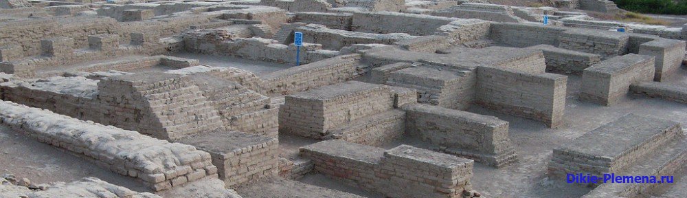
 The most ancient monuments, allowing us to talk about the existence of cultural states in India, were discovered in northwestern India, in the Indus basin in Harappa (Punjab) and in Mohenjo-Daro (Sindh province). The streets were straight, ran parallel and intersected at right angles. At intersections, the corners of buildings were rounded so as not to interfere with street traffic. The entire Mohenjo-Daro is built of brick. Clay was used as a material for bricks, which, unlike the Sumerians and Egyptians, they did not mix with straw. A mud solution was used as a binding material, and in special cases, gypsum solution. The appearance of the two-story houses of the Mohenjodar residents was rather inconspicuous: high blank walls without windows and only tiny openings under the roof itself. Bust of a priest (18 cm) from Mohenjo-Daro
 But in every house there was an entrance hall, a living room, a courtyard, stairs, benches, and in almost all dwellings there were toilets with showers. Carefully designed sewage system. Many household items and works of art were found in the ruins, in particular various types pottery made without a potter's wheel. Along with painted ceramics, terracotta figurines of people and animals, rings made of blue glass paste, dice and checkers were found here. Of particular interest are stone tools made of horn and stone and a very small number of metal objects. Seals made of hard stone, soft soapstone, ivory and clay were found in large quantities. These seals are covered with religious images of sacred animals (especially the bull), and the Mohenjo-Daro Excavations are also covered with inscriptions.
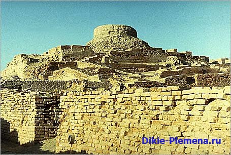
 Great bath of the 3rd millennium BC. e. from Mohenjo Dar The Indus Valley contains ruins of Bronze Age cities (2500–1500 BC) with strict street layouts, water systems, palaces and public buildings.
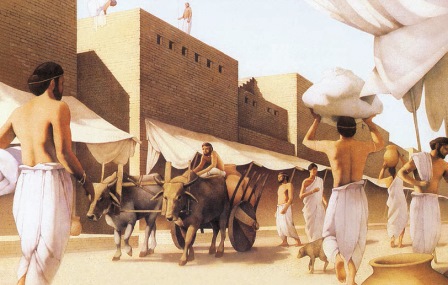
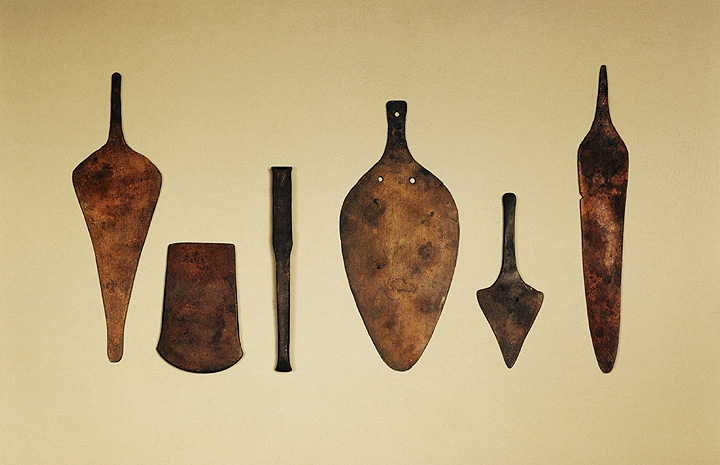
 The main occupation of the people of the Indus Valley was agriculture. The importance of agriculture is evidenced by the findings of a huge number of grain grinders. Agricultural products were stored in special barns. Excavations indicate the cultivation of two varieties of wheat, barley, millet, peas, sesame, sesame, cotton, melon, and the development of horticulture. They raised cows, sheep, goats, zebu, pigs, and also kept chickens. There were dogs, domestic cats, and donkeys in the settlements. Fishing played a significant role. Tools and weapons were made from copper and bronze: knives, axes, mirrors, razors, daggers, swords, arrow and spear tips, maces. The Harappans were well versed in smelting, forging and casting metals. In addition, gold, silver, and lead were used. Various jewelry was made from gold, and vessels were made from silver. In addition to metals, stone was still widely used in the economy.
 Indo-Aryan period XIII-VI centuries. BC e with the arrival of the Aryan nomads, who became farmers and cattle breeders. The Vedas are the main source of information about their lives; they were written in Sanskrit (ancient literary language India). Castes numbering more than two thousand play an important role in life. Castes were formed on the basis of four varnas: brahmans (priests); kshatriyas (warriors); Vaishyas (farmers, artisans, traders); Shudras (slaves and prisoners of war). The first religion of India is Vedism - the religion of the Vedas. It is characterized by polytheism and the endowment human qualities animals, objects (anthropomorphism).

 Religion Brahmanism is formed in the 1st millennium BC. e. This is a more harmonious teaching about the world, many gods are reduced to a trinity. Gradually, Brahmanism turns into Hinduism, which is the most widespread religion in India, accounting for more than 80% of believers. Hinduism exists in the form of directions: - Vaishnavism; - Shaivism; - Krishnaism. Hinduism includes many cults through the concept of avatars (incarnations) of Vishnu. That is, Vishna descends into the world, reincarnating in various images (taking the forms of Rama, Krishna and Buddha). "Bhagavadgita" - Holy Bible Hinduism. The basis of Hinduism is the doctrine of the eternal transmigration of souls (samsara), which occurs in accordance with the law of retribution (karma) for everything done in life.
 Basic practices and beliefs Drachma - moral duty Samsara - the cycle of birth and death Karma - the belief that actions affect the quality of rebirth Yoga - a set of physical and spiritual (meditative) exercises Sacred books of Hinduism Mahabharata Ramayana
 God Brahma is (one of the Aryan gods) the creator and ruler of the world. He gave people laws and is responsible for the eternal kaleidoscope natural forms. God Shiva is a formidable carrier of cosmic energy, which both creates and destroys. Shiva can destroy, or he can save.
 Guardian God Vishnu saves people from various disasters, such as floods. Vishnu repeatedly took on earthly incarnations, avatars, each time in order to save the Universe from disaster.
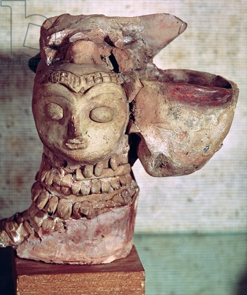
 Mother goddess of the 3rd millennium BC. e. from Mohenjo-Daro Terracotta Goddess of the Ganges River 5th century. North India Terracotta
 Khajuraho in Central India is home to a huge temple complex. It was built in 950 -1050. and includes over 80 structures. The temples (only 24 of them have survived) were erected at the behest of the powerful rulers of the Chandella dynasty.
 The mystical analogue of the body - sacrifice and mountain - is a Hindu temple, such as the Shiva Kadarya Mahadeva Temple in Khajuraho.

 The largest and most famous building is the Kandarya Mahadeva Temple, dedicated to Shiva, one of the three supreme gods. It was built in the 11th century. The 31st-high Shiva temple represents the sacred Mount Meru, surrounded by column-spires (84 in total). The sanctuary houses a special image of the god - Shiva Linga, made of marble.
 Conquest of India by Alexander the Great in 327 BC. e. Alexander the Great, at the head of an army of one hundred thousand, moved east with the goal of conquering all Asian countries known to the Greeks. His army moved from Nicaea, passed through Sogdiana and Bactria, then, walking along Kabul, penetrated into northwestern India, reaching the Indus and the Pyatirechye region. The Gandhara tribe, formerly under the rule Persian kings and having fallen to some extent under the influence of Hellenistic culture, joined Alexander. Alexander Porus, king of the state of Puru, offered especially stubborn resistance. Porus marched against Alexander with a large army consisting of 30 thousand infantry, 4 thousand horsemen, 300 chariots and 200 elephants. However, Alexander won a great victory over him and completely defeated his troops, who lost about 12 thousand people killed. Having won a number of brilliant victories, Alexander the Great and his army reached the Hyphasis River, but due to the army’s refusal to continue the campaign, he was forced to return. Part of the Macedonian army, led by Nearchus, was sent back by sea, and Alexander himself, with small remnants of the other half of the army, returned through the waterless desert of Gedrosia and soon died (in 323).
 Chandragunta (321-297 BC) Chandragupta, founder new dynasty Maurya. According to some sources, Chandragupta was a young kshatriya, according to others, he was the illegitimate son of the last king of the Nanda dynasty and even came from the Shudra family. In 318, Chandragupta captured all of northern India up to Narbada and formed a new large and powerful state in India. Having overthrown the last representative of the Nanda dynasty, Chandragupta continued the activities of his warlike predecessors. After the death of Alexander the Great, one of Alexander's generals, Seleucus, having strengthened himself in Syria, made an attempt to reconquer northern India in 305 BC. e. However, having started a war with Chandragupta, Seleucus failed. He was forced not only to retreat, but even to cede to Chandragupta in exchange for 500 war elephants a number of regions of his state: Aria, Arachosia, the eastern part of Gedrosia and the country of the Parapamisadas.
 Mauryan Empire (IV-III centuries BC) Mauryan Power. IV-III centuries BC e. the creation of an all-Indian Mauryan power (317 -180 BC), with its capital in Pataliputra (it was described by Megasthenes, who arrived at Chandragupta’s court). The struggle for influence between the nobility from the state of Magadha, the Nanda dynasty, and Chandrogupta (Sandracott), who led the anti-Macedonian movement during the period of conquest of Alexander the Great. The Mauryan power reached its peak in the middle. III century BC e. under Chandrogupta's grandson Ashok. Ashok united many territories (from Kabul to the Deccan in the South / the southern regions of Hindustan were not included /), from the mouth of the Indus to the mouth of the Ganges. The conquest of the provinces did not destroy the previous dynasties in them. The power of the king was limited by the royal council, consisting of the king's relatives and representatives of the most noble families. The Mauryas patronized Buddhism, a then non-traditional religion. Brahmin priests were traditional.
 Ashoka (272-232 BC) Ashoka, son and successor of Bindusara. From his father and grandfather he inherited a large and powerful state. Even during Bindusara's lifetime, Ashoka served as the king's viceroy in northwestern and then western India, thus receiving good preparation to govern the entire state. Ashoka ascended the throne as a very young man in 272. Almost no information has been preserved about the first years of his reign. It is only known that in 261 Ashoka began a war with the kingdom of Kalinga, which he conquered after a stubborn struggle. With this, he completed the unification of almost all of India within one state, begun by Chandragupta.
 Buddhism appears in India in the 6th century BC. e. Its creator is Sidzhartha Gautama, who at the age of 40 reached the state of enlightenment (nirvana) and received the name Buddha (enlightened one). In the 3rd century. BC e. Buddhism reached its greatest spread, displacing Brahmanism, but at the beginning of the 2nd millennium AD. e. he dissolves into Hinduism. Today Buddhism is widespread in China, Japan and other countries. The basis of Buddhism is the doctrine of the “four noble truths”. The path to salvation lies through the renunciation of worldly temptations, through self-improvement. The highest state of nirvana is the borderline state between life and death, meaning complete detachment from the outside world, the absence of any desires, complete satisfaction, inner enlightenment.

 Buddhist temples In India, Stupas are the most common burial structures. It is believed that sacred relics of Buddha are kept in Stupas. Around the Stupas there is often a fence dotted with reliefs that describe the life of the Buddha.

 Ajanta Cave Monastery The creation of this monastery dates back to the 3rd -6th centuries. It consists of 29 caves carved into the rocks and connected by a wide path. The ceilings of the caves are supported by carved and painted columns. This cave gained fame thanks to its paintings on the themes of Buddhist legends.


 First centuries new era- predominance of the Kushan state. Numerous finds of Kushan coins indicate the breadth economic ties during the Kushan period. IV-V centuries n. e. - In northern India, the territories were again united by the rulers of Magadha (the Gupta dynasty). The heyday of the Gupta state - Chandrogupta II (380 -415 AD). But internal strife and the invasion of the Hephthalite Huns in the end. V - beginning VI centuries led to the collapse of the state. Socio-economic relations in the Classical period. The Indians learned to smelt steel, which was also known to the Greeks. An iron column with the inscription of King Chandra (probably Chandrogupta II) is known - for one and a half thousand years, practically no rust has appeared on it. Fortresses were no longer built from wood, but from stone. During this era, the art of coinage reached its peak. with images of rulers and inscriptions in various languages
At the beginning of the 20th century. In archaeological science, there is a strong opinion that the Middle East is the birthplace of the productive economy, urban culture, writing, and, in general, civilization. This area, according to the apt definition of the English archaeologist James Breasted, was called the “Fertile Crescent”. From here, cultural achievements spread throughout the Old World, to the west and east. However, new research has made serious adjustments to this theory.
The first finds of this kind were made already in the 20s. XX century. Indian archaeologists Sahni and Banerjee discovered civilization on the banks of the Indus, which existed simultaneously from the era of the first pharaohs and the era of the Sumerians in the III-II millennia BC. e. (three of the most ancient civilizations in the world). A vibrant culture with magnificent cities, developed crafts and trade, appeared before the eyes of scientists. unique art. First, archaeologists excavated the largest urban centers of this civilization - Harappa and Mohenjo-Daro. By the name of the first she received name - Harappan civilization. Later, many other settlements were found. Now about a thousand of them are known. They covered the entire Indus Valley and its tributaries with a continuous network, like a necklace covering the northeastern coast of the Arabian Sea in the territory of present-day India and Pakistan.
The culture of ancient cities, large and small, turned out to be so vibrant and unique that researchers had no doubt: this country was not the outskirts of the Fertile Crescent of the world, but an independent center of civilization, today a forgotten world of cities. There is no mention of them in written sources, and only the earth retained traces their former greatness.
Map. Ancient India - Harappan civilization

History of ancient India - Proto-Indian culture of the Indus Valley

Other the mystery of ancient Indian civilization- its origin. Scientists continue to debate whether it had local roots or was introduced from outside, with whom intensive trade was carried out.
Most archaeologists believe that Proto-Indian civilization grew out of local early agricultural cultures that existed in the Indus Basin and the neighboring region of Northern Balochistan. Archaeological discoveries support their point of view. In the foothills closest to the Indus Valley, hundreds of settlements of ancient farmers dating back to the 6th-4th millennia BC have been discovered. e.
This transition zone between the mountains of Baluchistan and the Indo-Gangetic plain provided the first farmers with everything they needed. The climate was favorable for growing plants during the long, warm summers. Mountain streams provided water for irrigating crops and, if necessary, could be blocked by dams to retain fertile river silt and regulate field irrigation. The wild ancestors of wheat and barley grew here, and herds of wild buffalo and goats roamed. Flint deposits provided raw materials for making tools. The convenient position opened up opportunities for trade contacts with Central Asia and Iran in the west and the Indus Valley in the east. This area was more suitable than any other for the emergence of agriculture.
One of the first agricultural settlements known in the foothills of Balochistan was called Mergar. Archaeologists excavated a significant area here and identified seven horizons of the cultural layer in it. These horizons, from the lower, most ancient, to the upper, dating back to the 4th millennium BC. e., show the complex and gradual path of the emergence of agriculture.

In the earliest layers, the basis of the economy was hunting, with agriculture and cattle breeding playing a secondary role. Barley was grown. Of the domestic animals, only the sheep was domesticated. At that time, the residents of the settlement did not yet know how to make pottery. Over time, the size of the settlement increased - it stretched along the river, and the economy became more complex. Local residents built houses and granaries from mud bricks, grew barley and wheat, raised sheep and goats, made pottery and painted it beautifully, at first only in black, and later in different colors: white, red and black. The pots are decorated with whole processions of animals walking one after another: bulls, antelopes with branched horns, birds. Similar images have been preserved in Indian culture on stone seals. In the economy of farmers, hunting still played an important role, they did not know how to process metal and made their tools from stone. But gradually a stable economy was formed, developing on the same basis (primarily agriculture) as the civilization in the Indus Valley.
During the same period, stable trade relations with neighboring lands developed. This is indicated by the widespread decoration among farmers made from imported stones: lapis lazuli, carnelian, turquoise from Iran and Afghanistan.

Mergar society became highly organized. Public granaries appeared among the houses - rows of small rooms separated by partitions. Such warehouses acted as central distribution points for food. The development of society was also expressed in the increase in the wealth of the settlement. Archaeologists have discovered many burials. All residents were buried in rich outfits with jewelry from beads, bracelets, pendants.
Over time, agricultural tribes settled from mountainous areas to river valleys. They reclaimed the plain irrigated by the Indus and its tributaries. The fertile soil of the valley contributed to the rapid growth of population, the development of crafts, trade and agriculture. Villages grew into cities. The number of cultivated plants increased. A date palm appeared, in addition to barley and wheat, they began to sow rye, grow rice and cotton. Small canals began to be built to irrigate fields. They tamed a local species of cattle - the zebu bull. So it grew gradually the most ancient civilization of the north-west of Hindustan. At an early stage, scientists identify several zones within the range: eastern, northern, central, southern, western and southeastern. Each of them is characterized its own characteristics. But by the middle of the 3rd millennium BC. e. the differences have almost disappeared, and in its heyday The Harappan civilization entered as a culturally unified organism.
True, there are other facts. They bring doubts into the slender theory of the origin of the Harappan, Indian civilization. Biological studies have shown that the ancestor of the domestic Indus Valley sheep was a wild species that lived in the Middle East. Much in the culture of the early farmers of the Indus Valley brings it closer to the culture of Iran and Southern Turkmenistan. By language, scientists establish a connection between the population of Indian cities and the inhabitants of Elam, an area that lay east of Mesopotamia, on the coast of the Persian Gulf. Judging by the appearance of the ancient Indians, they are part of one large community that settled throughout the Middle East - from the Mediterranean Sea to Iran and India.
Adding up all these facts, some researchers have concluded that Indian (Harappan) civilization is a fusion of various local elements that arose under the influence of Western (Iranian) cultural traditions.
Decline of Indian civilization

The decline of the proto-Indian civilization also remains a mystery, awaiting a final solution in the future. The crisis did not start all at once, but spread throughout the country gradually. Most of all, as evidenced by archaeological data, the large centers of civilization located on the Indus suffered. In the capitals Mohenjo-Daro and Harappa, it took place in the 18th-16th centuries. BC e. In all probability, decline Harappa and Mohenjo-Daro belong to the same period. Harappa lasted only slightly longer than Mohenjo-Daro. The crisis hit the northern regions faster; in the south, far from the centers of civilization, Harappan traditions persisted longer.
At that time, many buildings were abandoned, hastily made stalls were piled up along the roads, new small houses grew up on the ruins of public buildings, deprived of many of the benefits of a dying civilization. Other rooms were rebuilt. They used old bricks selected from destroyed houses. They did not produce new bricks. In cities there was no longer a clear division into residential and craft districts. There were pottery kilns on the main streets, which was not allowed in former times of exemplary order. The number of imported things decreased, which means that external relations weakened and trade declined. Craft production decreased, ceramics became coarser, without skillful painting, the number of seals decreased, and metal was used less often.
What appeared the reason for this decline? The most likely reasons seem to be of an environmental nature: a change in the level of the seabed, the Indus riverbed as a result of a tectonic shock that resulted in a flood; change in monsoon direction; epidemics of incurable and possibly previously unknown diseases; droughts due to excessive deforestation; soil salinization and the onset of desert as a consequence of large-scale irrigation...
The enemy invasion played a certain role in the decline and death of the cities of the Indus Valley. It was during that period that the Aryans, tribes of nomads from the Central Asian steppes, appeared in North-Eastern India. Perhaps their invasion was the last straw in the balance of the fate of the Harappan civilization. Due to internal turmoil, the cities were unable to withstand the onslaught of the enemy. Their inhabitants went to look for new, less depleted lands and safe places: to the south, to the sea, and to the east, to the Ganges valley. The remaining population returned to a simple rural lifestyle, as it had been a thousand years before these events. It perceived Indo-European language and many elements of the alien nomadic culture.
What did people look like in ancient India?
What kind of people settled in the Indus Valley? What did the builders of magnificent cities, the inhabitants of ancient India, look like? These questions are answered by two types of direct evidence: paleoanthropological materials from Harappan burial grounds and images of ancient Indians - clay and stone sculptures that archaeologists find in cities and small villages. So far these are few burials of residents of proto-Indian cities. Therefore, it is not surprising that conclusions regarding the appearance of the ancient Indians often changed. At first, it was assumed that the population would be racially diverse. The city organizers showed features of the proto-Australoid, Mongoloid, and Caucasian races. Later, the opinion was established about the predominance of Caucasian features in the racial types of the local population. The inhabitants of proto-Indian cities belonged to the Mediterranean branch of the large Caucasoid race, i.e. were mostly human dark-haired, dark-eyed, dark-skinned, with straight or wavy hair, long-headed. This is how they are depicted in sculptures. Particularly famous was the carved stone figurine of a man wearing clothes richly decorated with a pattern of shamrocks. The face of the sculptural portrait is made with special care. Hair grabbed with a strap, a thick beard, regular features, half-closed eyes give a realistic portrait of a city dweller,
The ancient city of Lothal, which arose 2400 years ago. BC.


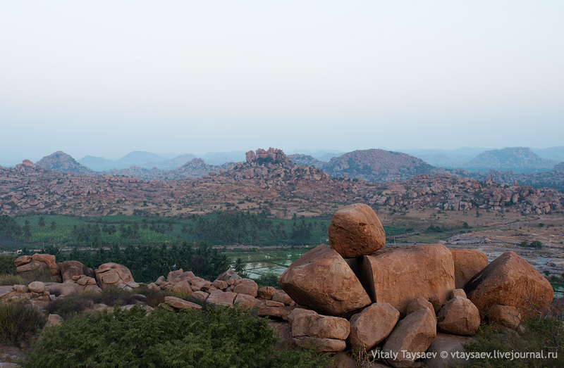
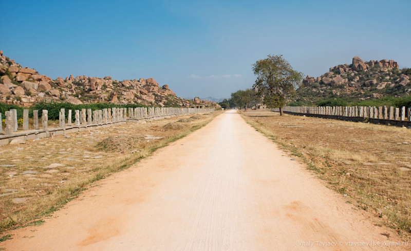
Hampi - the lost capital of the Vijayanagara Empire
In the southern Indian state of Karnataka, on the banks of a river with the unpronounceable name Tungabhadra, among mighty granite boulders, there are the ruins of the capital of the once powerful Vijayanagar Empire. The remains of Vijayanagara belong to the UNESCO World Heritage Sites, where they are listed as "Hampi Monuments". It seems that nature itself has given people a scoop and a sandbox to realize their desires and ambitions. Outcrops of gray coarse granite in the heart of the Deccan plateau, the presence of waterways and fertile soil have attracted people here since the 1st century AD.
It was once home to almost half a million people and was one of the largest cities in India.
Various crafts, literature, music and architecture have achieved the greatest development here. Countless travelers from all over the world have tried in vain to describe the wonders of Vijayanagara.


A reasonable question arises: “How did the craftsmen cut and process durable and dense granite?” Many pseudoscientists claim that ancient peoples cut these huge boulders with lasers or incredible space technologies.
“A thousand columns” stretch along the road. Their purpose is not known for certain. It remains to be assumed that there used to be covered shopping arcades for the city market here.
This is a real masterpiece of stone carvers - a granite chariot. Now you can see that there are elephants in harness. However, before there were horses in their place

Hampi
Culture of Harappa and Mohenjo-daro
Mohenjo-daro
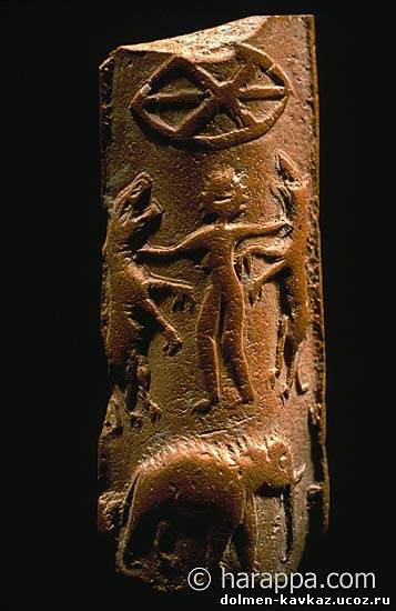
Hercules on the seals of the city
Dishes from Mohenjo-Daro


Harappan culture
Priest

On the streets of Mohenjo-Daro
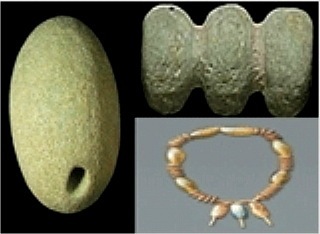
decoration from Mohenjo-daro

Tools
Desk lamp
In all likelihood, the Harappans traded with the Sumerians. The Sumerian writings mentioned cities with which they traded. Among them was a city called Meluke; scientists identify it with the proto-Indian city of Mohenjo - Daro. Large quantities of remains of cotton fabrics, a variety of earthenware beads, and shells were found on Harappan territory - all of this was of foreign origin.
Excavation at Mohenjo-daro

Seals from Mohenjo-daro

Pottery and textile tools were found among the ruins. Pottery workshops were located throughout the city. Almost everything was made there, from pipes and bricks to thin-walled vessels, elegant figurines and jewelry. Residents also used objects made of copper, tin, and bronze - these were tools, jewelry and weapons. True, the weapon was made very crudely; there was probably no military action in this territory. The Harappan people were never able to master iron smelting.
Harappan pottery

Harappan game

Pre-Harappan culture

Harappan figurines

Harappan pottery

Terracotta figurines from Harappa
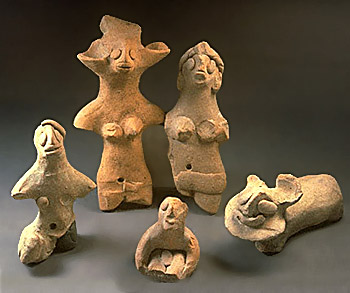
Terracotta

Harappan script


One or two rooms for ablutions (in a modern way, two bathrooms), ventilation ducts. No air conditioners have been found yet.
An incredibly advanced system separate sewers with sedimentation tanks and even... public toilets. Water supply. Rainwater was drained from the roofs through specially shaped pottery pipes so that splashes would not fall on passers-by. The walls were plastered, but all this, the decoration, the paint and the upper floors, had disappeared.

The quality of the masonry is unusually high, includes many techniques (no arched vault), and stone slabs for chic. Here's a room on the second floor

Harappa
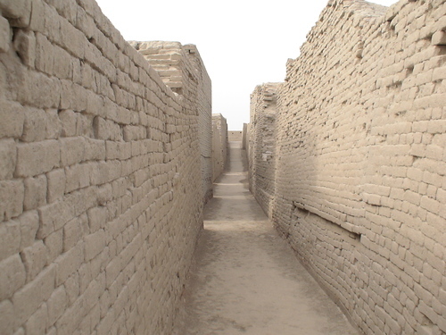
The houses had 2-3 floors, at least 8x9 m, at least one courtyard and wells. This is not a tower, this is a well (cistern?) from the second floor.
Harappa

Harappa
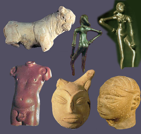
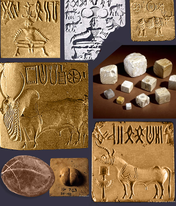

Hieroglyphs from Harappa
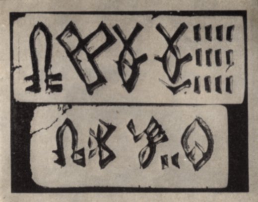


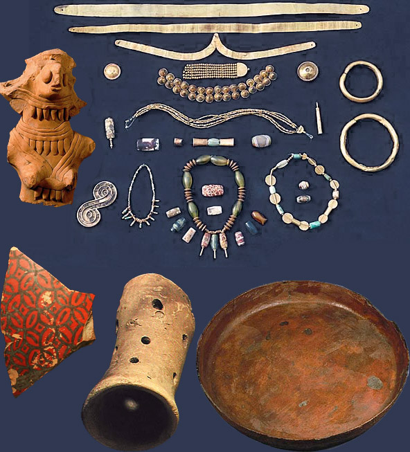

The decline of civilization was apparently due to natural causes. Climate change or earthquakes may have altered the flow of rivers or dried them out and depleted the soils. The farmers were no longer able to feed the cities, and the inhabitants abandoned them. The huge social and economic complex disintegrated into small groups. Writing and other cultural achievements were lost. There is nothing to suggest that the decline occurred overnight. Instead of empty cities in the north and south, new settlements appeared at this time, people moved east, to the Ganges valley.

The floors of rich houses are also brick, the swimming pools are coated with bitumen. Some floors are covered with an unknown glassy composition, and under some there are channels for air heating

City plan
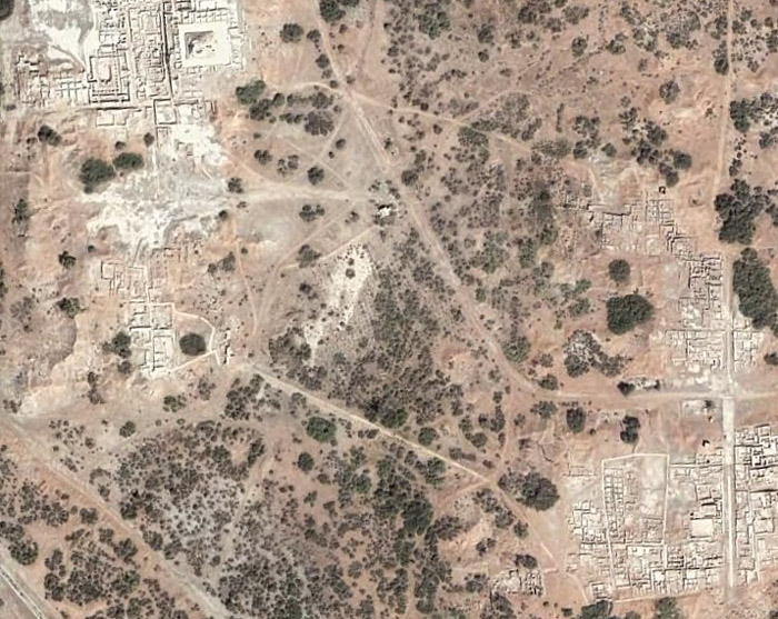
Ceramics. Mohenjo-Daro. 4500 Sun.

Clay seal from Harappa but not yet deciphered.

The Indus Valley Civilization was a largely urban culture, trading with the Sumerians from southern Mesopotamia.
By far the most exquisite, and rare, artifact found to date is a small, square-shaped seal with an engraving of an animal. Despite the efforts of philologists from all parts of the world, and despite the use of computers, the content of the text remains undeciphered.
Although historians agree that the civilization declined sharply, there is disagreement about the possible reasons for its end. Conquerors from Central and Western Asia, according to some historians, were the cause of the disappearance Indus Valley civilization, but this opinion is open to discussion and debate. More plausible explanations are repeated floods caused by tectonic movements lands, soil salinization, desertification.
Bulls harnessed to a cart. Children's toy found in Harappan civilization excavations

Necklace made of spiral copper wire. Traces of silk remain inside. These are the earliest traces of the use of wild fibers silkworm in South Asia. Harappa 3B: around 2450 - 220 BC
Harappan figurines

A female burial site disturbed by ancient robbers. A baby is buried under the mother's feet. Harappa is one of the two capitals ancient civilization in the Indus River basin.


